- Gratis verzending vanaf 30 euro
- Levert in Nederland, België etc.
- Meer dan 30.000 titels
- Vakkundige klantenservice
- Snelle levering
- Veilig en eenvoudig betalen

Direct contact?
Bel +31 (0)6 42428571
maandag t/m vrijdag
van 10 tot 17 uur
Wegenkaart - landkaart Alaska's Inside Passage Seattle to Anchorage | ITMB Map
Vancouver

De ITMB kaarten kenmerken zich door een kleurrijke en volle cartografische weergave. Het zijn degelijke kaarten, zeker voor gebieden waarvoor kaarten lastig te krijgen zijn, met aanduidingen van onder andere nationale parken en natuurgebieden, vliegvelden, toeristische bezienswaardigheden en een goede aanduiding van het wegennet. Daarnaast bevatten enkele kaarten ook stadsplattegronden (hoofdsteden of belangrijke centra). Bevat voor sommige landen ook aanduidingen in de orginele taal. The west coast of North America is so long that we have divided it into segments - the Central American and Mexican segments are shown on maps of those areas. We recently released our USA Pacific Coast Map, covering the segment between San Diego and Vancouver. This map completes the mapping of the Pacific Ocean coastline by mapping the routes followed by cruise ships and Alaska Ferries heading north from Seattle and Vancouver to Alaska. This is a double-sided map, with Vancouver Island and the coastline as far north as Prince Rupert on one side (with inset maps of Seattle, Victoria, and Vancouver)on side 1, and the coastline north to Glacier Bay and an onward inset map to Anchorage (including an inset map of the city) on the second side. As the actual routes followed by the numerous cruise lines vary, we can't show their actual sailing routes, but they generally follow the coastline within viewing distance of either the mainland or coastal islands, or both. We have included the normal ferry routes followed by both BC Ferries and Alaska Ferries in their network of watery trails joining coastal communities, and the large cruise ships follow much the same routes. Legend Includes: Roads by classification, International Boundaries, Provincial Boundaries, Railways, Mountain Peaks, Population Areas, Province Capitals, Major Cities, Cities, Provincial Parks, Lakes, Rivers, National Parks, Snowfields, Glaciers, Border Crossing, Airports, Airfields, Points of Interest, Viewpoints, Hotels and Accomodations, Day-Use Areas, Camping, Boat Launches, Fishing, Museums, Gas Stations, Universities, Skiing, Golf Courses, Hospitals and Medical Services, Mines, Passes, Campground RV, Hiking, Kayaking and much more
Schaal: 1:900.000
Engelstalig
EAN: 9781771291095
Uitgeverij: ITMB (International Tavel Maps & Books)
Verschijningsdatum: 2023
Meest recente editie
Engelstalig


Op voorraad
Levertijd 3 dagen (Nederland)
- Vakkundige klantenservice
- Groot assortiment
- Gratis retourneren binnen 14 dagen
- Aangesloten bij WebwinkelKEUR
€ 13,50
Meer producten die interessant kunnen zijn
Wandelkaarten Alaska
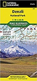
Wandelkaart 222 Alaska Denali (Alaska) - Trails Illustrated Map / National Park Maps National Geographic
Water- en scheurvaste wandelkaart
€ 16,99

Wandelkaart 255 Alaska Glacier Bay (Alaska) - Trails Illustrated Map / National Park Maps National Geographic
Water- en scheurvaste wandelkaart
€ 16,99
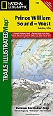
Wandelkaart 761 Alaska Prince William Sound, West (Alaska) - Trails Illustrated Map / National Park Maps National Geographic
Water- en scheurvaste wandelkaart
€ 16,99