- Gratis verzending vanaf 30 euro
- Levert in Nederland, België etc.
- Meer dan 30.000 titels
- Vakkundige klantenservice
- Snelle levering
- Veilig en eenvoudig betalen

Direct contact?
Bel +31 (0)6 42428571
maandag t/m vrijdag
van 10 tot 17 uur
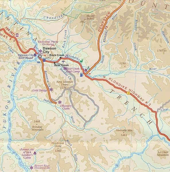
Wegenkaart - Landkaart Yukon Territory & British Columbia Noord Dawson City, Watson Lake, White Horse - ITMB Map
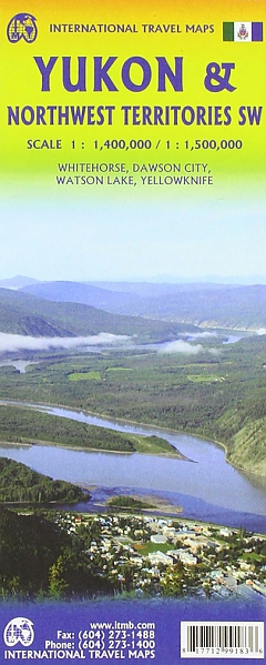
De ITMB kaarten kenmerken zich door een kleurrijke en volle cartografische weergave. Het zijn degelijke kaarten, zeker voor gebieden waarvoor kaarten lastig te krijgen zijn, met aanduidingen van onder andere nationale parken en natuurgebieden, vliegvelden, toeristische bezienswaardigheden en een goede aanduiding van het wegennet. Daarnaast bevatten enkele kaarten ook stadsplattegronden (hoofdsteden of belangrijke centra). Bevat voor sommige landen ook aanduidingen in de orginele taal. The Yukon is one of those magical places that attracts visitors like a magnet. It is wild, but has all the mod cons, it is the land of the midnight sun in summer and frigidly cold in winter. It has gold and diamonds and historic towns and paddle steamers and wilderness to tempt the most jaded of souls! It is a wonderful, exotic part of Canada and one of the most popular travel destinations in North America; double-sided; with inset maps of Whitehorse, Dawson City, and Watson Lake. Legend Includes: National and provincial boundaries, main and secondary roads, trails, highway stops, settlements, accommodations, wilderness lodges, points of interest, wildlife viewing areas, gas stations, international airports, national parks.
Schaal: 1:1.400.000
Engelstalig
EAN: 9781771291033
Uitgeverij: ITMB (International Tavel Maps & Books)
Verschijningsdatum: 2023
Meest recente editie
Engelstalig

Op voorraad
Vóór 17 uur op werkdagen besteld, morgen in huis (Nederland)
- Vakkundige klantenservice
- Groot assortiment
- Gratis retourneren binnen 14 dagen
- Aangesloten bij WebwinkelKEUR
€ 13,50