- Gratis verzending vanaf 30 euro
- Levert in Nederland, België etc.
- Meer dan 30.000 titels
- Vakkundige klantenservice
- Snelle levering
- Veilig en eenvoudig betalen

Direct contact?
Bel +31 (0)6 42428571
maandag t/m vrijdag
van 10 tot 17 uur
Pathfinder
|
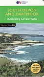
Wandelgids 01 South Devon and Dartmoor Pathfinder Guide | Pathfinder Guide 01 | Met Ordanance Survey kaartenDeze Pathfinder Guide is een goed uitgevoerde gids met verschillende wandelingen in Groot-Britannië. De gids bevat naast goede topografische kaarten van de Britse topografische dienst (Ordanance Survey) ook beschrijvingen van het landschap, de cultuur en/of de flora en fauna. Verder is de gids voorzien van praktische informatie zoals startpunten, verwachte wandeltijd, restaurants en cafés voor onderweg. This collection of 28 circular walks are in an area acclaimed as the last great wilderness in Britain. The haunting beauty of the central moorland studded with old ti... |
17,99 |
|
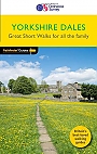
Wandelgids 01 Yorkshire Dales Pathfinder Guide (Short Walks) | 20 korte wandelingen 3 tot 9km.Deze Pathfinder Guide is een goed uitgevoerde gids met verschillende wandelingen in Groot-Britannie. De gids bevat naast goede topografische kaarten van de Britse topografische dienst (Ordanance Survey) ook beschrijvingen van het landschap, de cultuur en/of de flora en fauna. Verder is de gids voorzien van praktische informatie zoals startpunten, verwachte wandeltijd, restaurants en cafes voor onderweg. Many characteristics of the Yorkshire Dales alter day by day, changing with the seasons, the weather and the hour-making the area an ideal destination for the walker. T... |
11,50 Tijdelijk niet leverbaar |
|
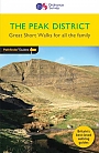
Wandelgids 02 Peak District Pathfinder Guide (Short Walks) | 20 korte wandelingen 3 tot 9km.Deze Pathfinder Guide is een goed uitgevoerde gids met verschillende wandelingen in Groot-Britannie. De gids bevat naast goede topografische kaarten van de Britse topografische dienst (Ordanance Survey) ook beschrijvingen van het landschap, de cultuur en/of de flora en fauna. Verder is de gids voorzien van praktische informatie zoals startpunten, verwachte wandeltijd, restaurants en cafes voor onderweg. This new-style edition of Pathfinder: Short Walks Peak District is fully updated and features 20 fantastic family walks ranging in length from 2 to 6 miles. Each walk i... |
11,50 |
|
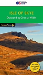
Wandelgids 03 Isle of Skye Pathfinder Guide | Pathfinder Guide 03 | Met Ordanance Survey kaartenDeze Pathfinder Guide is een goed uitgevoerde gids met verschillende wandelingen in Groot-Britannië. De gids bevat naast goede topografische kaarten van de Britse topografische dienst (Ordanance Survey) ook beschrijvingen van het landschap, de cultuur en/of de flora en fauna. Verder is de gids voorzien van praktische informatie zoals startpunten, verwachte wandeltijd, restaurants en cafes voor onderweg. Are you planning a visit to the Isle of Skye? Do you enjoy a walk in the country or a leisurely afternoon stroll? Britain's best loved walking guides brings yo... |
17,99 |
|
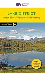
Wandelgids 03 Lake District Pathfinder Guide (Short Walks) | 20 korte wandelingen 3 tot 9km.Deze Pathfinder Guide is een goed uitgevoerde gids met verschillende wandelingen in Groot-Britannie. De gids bevat naast goede topografische kaarten van de Britse topografische dienst (Ordanance Survey) ook beschrijvingen van het landschap, de cultuur en/of de flora en fauna. Verder is de gids voorzien van praktische informatie zoals startpunten, verwachte wandeltijd, restaurants en cafes voor onderweg. Short Walks Lake District covering parts of Keswick, Patterdale and Hawkshead. This selection offers interest and regional variety in the Lake District, providing the b... |
11,50 Tijdelijk niet leverbaar |
|
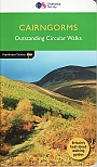
Wandelgids 04 Cairngorms Pathfinder Guide | Pathfinder Guide 04 | Met Ordanance Survey kaartenDeze Pathfinder Guide is een goed uitgevoerde gids met verschillende wandelingen in Groot-Britannië. De gids bevat naast goede topografische kaarten van de Britse topografische dienst (Ordanance Survey) ook beschrijvingen van het landschap, de cultuur en/of de flora en fauna. Verder is de gids voorzien van praktische informatie zoals startpunten, verwachte wandeltijd, restaurants en cafés voor onderweg. The Cairngorms cover 300 sq miles, making it the most mountainous area in Britain, with an equally wide range of wildlife. This walking guidebook contains 28 carefull... |
17,99 |

|
Wandelgids 04 Cotswolds Pathfinder Guide (Short Walks) | 20 Korte wandelingen tot 8kmDeze Pathfinder Guide is een goed uitgevoerde gids met verschillende wandelingen in Groot-Britannië. De gids bevat naast goede topografische kaarten van de Britse topografische dienst (Ordanance Survey) ook beschrijvingen van het landschap, de cultuur en/of de flora en fauna. Verder is de gids voorzien van praktische informatie zoals startpunten, verwachte wandeltijd, restaurants en cafés voor onderweg. 20 Korte wandelingen tot 8km. This book contains 20 short circular walks, all rated by length and difficulty, that are carefully selected for the whole family to enjo... |
10,99 Tijdelijk niet leverbaar |
|
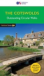
Wandelgids 06 Cotswolds Pathfinder Guide | Pathfinder Guide 6 | Met Ordanance Survey kaartenDeze Pathfinder Guide is een goed uitgevoerde gids met verschillende wandelingen in Groot-Britannie. De gids bevat naast goede topografische kaarten van de Britse topografische dienst (Ordanance Survey) ook beschrijvingen van het landschap, de cultuur en/of de flora en fauna. Verder is de gids voorzien van praktische informatie zoals startpunten, verwachte wandeltijd, restaurants en cafes voor onderweg. Pathfinder(R) Cotswolds covering parts of the Snowshill, Buckholt Wood and Burford. This selection offers interest, regional variety and balance of routes in the Cotswo... |
17,99 |
|
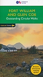
Wandelgids 07 Fort William & Glen Coe Walks Pathfinder Guide | Pathfinder Guide 7 | Met Ordanance Survey kaartenDeze Pathfinder Guide is een goed uitgevoerde gids met verschillende wandelingen in Groot-Britannië. De gids bevat naast goede topografische kaarten van de Britse topografische dienst (Ordanance Survey) ook beschrijvingen van het landschap, de cultuur en/of de flora en fauna. Verder is de gids voorzien van praktische informatie zoals startpunten, verwachte wandeltijd, restaurants en cafés voor onderweg. Fort William and Glen Coe encompass one of the greatest areas of sea and mountain landscape in Scotland, backed by some of the biggest and most deman... |
17,95 |
|
Wandelgids 08 Dartmoor Pathfinder Guide (Short Walks) | 20 korte wandelingen 7.5 kmDeze Pathfinder Guide is een goed uitgevoerde gids met verschillende wandelingen in Groot-Britannie. De gids bevat naast goede topografische kaarten van de Britse topografische dienst (Ordanance Survey) ook beschrijvingen van het landschap, de cultuur en/of de flora en fauna. Verder is de gids voorzien van praktische informatie zoals startpunten, verwachte wandeltijd, restaurants en cafes voor onderweg. Short Walks Dartmoor covering parts of Okehampton, Chagford and Lustleigh. This selection offers interest and regional variety in Dartmoor, providing the best short wal... |
11,50 |
|
Wandelgids 08 Kent Pathfinder Guide | Pathfinder Guide 8 | Met Ordanance Survey kaartenDeze Pathfinder Guide is een goed uitgevoerde gids met verschillende wandelingen in Groot-Britannië. De gids bevat naast goede topografische kaarten van de Britse topografische dienst (Ordanance Survey) ook beschrijvingen van het landschap, de cultuur en/of de flora en fauna. Verder is de gids voorzien van praktische informatie zoals startpunten, verwachte wandeltijd, restaurants en cafés voor onderweg. Walkers in Kent enjoy a number of long-distance footpaths, including the North Downs Way, Wealdway, Pilgrims' Way and Greensand Way, and sections of them are incorpor... |
17,99 |
|
Wandelgids 09 Exmoor and the Quantocks Pathfinder Guide | Pathfinder Guide 09 | Met Ordanance Survey kaartenDeze Pathfinder Guide is een goed uitgevoerde gids met verschillende wandelingen in Groot-Britannië. De gids bevat naast goede topografische kaarten van de Britse topografische dienst (Ordanance Survey) ook beschrijvingen van het landschap, de cultuur en/of de flora en fauna. Verder is de gids voorzien van praktische informatie zoals startpunten, verwachte wandeltijd, restaurants en cafés voor onderweg. Exmoor National Park comprises 265 square miles, of which about two-thirds lie in west Somerset and the remaining third in north Devon. Its northern boundar... |
17,99 Tijdelijk niet leverbaar |
|
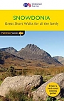
Wandelgids 10 Snowdonia Pathfinder Guide | Pathfinder Guide 10 | Met Ordanance Survey kaartenDeze Pathfinder Guide is een goed uitgevoerde gids met verschillende wandelingen in Groot-Britannië. De gids bevat naast goede topografische kaarten van de Britse topografische dienst (Ordanance Survey) ook beschrijvingen van het landschap, de cultuur en/of de flora en fauna. Verder is de gids voorzien van praktische informatie zoals startpunten, verwachte wandeltijd, restaurants en cafés voor onderweg. Pathfinder Snowdonia covering Bont Newydd, Aber and Tal-y-lln. This selection offers interest, regional variety and balance of routes in Snowdonia providing... |
17,99 |
|
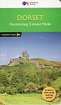
Wandelgids 11 Dorset Pathfinder Guide | Pathfinder Guide 11 | Met Ordanance Survey kaartenDeze Pathfinder Guide is een goed uitgevoerde gids met verschillende wandelingen in Groot-Britannië. De gids bevat naast goede topografische kaarten van de Britse topografische dienst (Ordanance Survey) ook beschrijvingen van het landschap, de cultuur en/of de flora en fauna. Verder is de gids voorzien van praktische informatie zoals startpunten, verwachte wandeltijd, restaurants en cafés voor onderweg. Dorset must rank as one of the most unspoilt counties in England. Dominating the landscape are the chalk downs open, sweeping, grassy uplands that stretch f... |
17,99 Tijdelijk niet leverbaar |
|
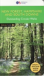
Wandelgids 12 New Forest, Hampshire and South Downs Pathfinder Guide | Pathfinder Guide 12 | Met Ordanance Survey kaartenDeze Pathfinder Guide is een goed uitgevoerde gids met verschillende wandelingen in Groot-Britannië. De gids bevat naast goede topografische kaarten van de Britse topografische dienst (Ordanance Survey) ook beschrijvingen van het landschap, de cultuur en/of de flora en fauna. Verder is de gids voorzien van praktische informatie zoals startpunten, verwachte wandeltijd, restaurants en cafés voor onderweg. From its chalk stream valleys and high downlands to its bluebell woods and wide purple heaths, Hampshire's varied landscapes make ideal walking country. The county's ... |
17,99 |
|
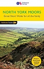
Wandelgids 13 North York Moors Pathfinder Guide (Short Walks) | 20 korte wandelingen 7.5 kmDeze Pathfinder Guide is een goed uitgevoerde gids met verschillende wandelingen in Groot-Britannie. De gids bevat naast goede topografische kaarten van de Britse topografische dienst (Ordanance Survey) ook beschrijvingen van het landschap, de cultuur en/of de flora en fauna. Verder is de gids voorzien van praktische informatie zoals startpunten, verwachte wandeltijd, restaurants en cafes voor onderweg. Short Walks North York Moors covering parts of Danby, Sutton Bank and Bridestone. This selection offers interest and regional variety in the North York Moors, providing... |
11,50 |
|
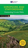
Wandelgids 14 Shropshire and Staffordshire Pathfinder Guide | Pathfinder Guide 14 | Met Ordanance Survey kaartenDeze Pathfinder Guide is een goed uitgevoerde gids met verschillende wandelingen in Groot-Britannie. De gids bevat naast goede topografische kaarten van de Britse topografische dienst (Ordanance Survey) ook beschrijvingen van het landschap, de cultuur en/of de flora en fauna. Verder is de gids voorzien van praktische informatie zoals startpunten, verwachte wandeltijd, restaurants en cafes voor onderweg. Britain's best loved walking guides brings you a brand new Pathfinder (R) Guide to Shropshire & Staffordshire Walks containing 28 fabulous walks exploring the unspo... |
17,99 Tijdelijk niet leverbaar |
|
Wandelgids 14 Snowdonia Pathfinder Guide (Short Walks) | 20 korte wandelingen 7.5 kmDeze Pathfinder Guide is een goed uitgevoerde gids met verschillende wandelingen in Groot-Britannie. De gids bevat naast goede topografische kaarten van de Britse topografische dienst (Ordanance Survey) ook beschrijvingen van het landschap, de cultuur en/of de flora en fauna. Verder is de gids voorzien van praktische informatie zoals startpunten, verwachte wandeltijd, restaurants en cafes voor onderweg. Short Walks Snowdonia covering parts of Abergynolwyn, Conwy and Snowdon. This selection offers interest and regional variety in Snowdonia, providing the best short walk... |
11,50 |
|
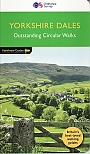
Wandelgids 15 Yorkshire Dales Pathfinder Guide | Pathfinder Guide 15 | Met Ordanance Survey kaartenDeze Pathfinder Guide is een goed uitgevoerde gids met verschillende wandelingen in Groot-Britannië. De gids bevat naast goede topografische kaarten van de Britse topografische dienst (Ordanance Survey) ook beschrijvingen van het landschap, de cultuur en/of de flora en fauna. Verder is de gids voorzien van praktische informatie zoals startpunten, verwachte wandeltijd, restaurants en cafés voor onderweg. The Yorkshire Dales include some of the most attractive countryside in Britain, distinctive because of the magnificent limestone landscape that forms much o... |
17,99 |
|
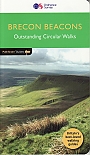
Wandelgids 18 Brecon Beacons Pathfinder Guide | Pathfinder Guide 18 | Met Ordanance Survey kaarteneze Pathfinder Guide is een goed uitgevoerde gids met verschillende wandelingen in Groot-Britannië. De gids bevat naast goede topografische kaarten van de Britse topografische dienst (Ordanance Survey) ook beschrijvingen van het landschap, de cultuur en/of de flora en fauna. Verder is de gids voorzien van praktische informatie zoals startpunten, verwachte wandeltijd, restaurants en cafés voor onderweg. Within the boundaries of the Brecon Beacons National Park there are four separate mountain ranges: Black Mountain, the most westerly, Fforest Fawr, th... |
17,99 |
|
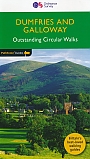
Wandelgids 19 Dumfries & Galloway Pathfinder Guide | Pathfinder Guide 19 | Met Ordanance Survey kaartenDeze Pathfinder Guide is een goed uitgevoerde gids met verschillende wandelingen in Groot-Britannië. De gids bevat naast goede topografische kaarten van de Britse topografische dienst (Ordanance Survey) ook beschrijvingen van het landschap, de cultuur en/of de flora en fauna. Verder is de gids voorzien van praktische informatie zoals startpunten, verwachte wandeltijd, restaurants en cafés voor onderweg. With 28 circular walks all created by experienced walkers, this Pathfinder walking guidebook for Dumfries and Galloway is ideal for both visitors and locals. The rout... |
17,99 |
|
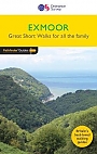
Wandelgids 21 Exmoor Pathfinder Guide (Short Walks) | Korte wandelingen tot 7.5 kmDeze Pathfinder Guide is een goed uitgevoerde gids met verschillende wandelingen in Groot-Britannie. De gids bevat naast goede topografische kaarten van de Britse topografische dienst (Ordanance Survey) ook beschrijvingen van het landschap, de cultuur en/of de flora en fauna. Verder is de gids voorzien van praktische informatie zoals startpunten, verwachte wandeltijd, restaurants en cafes voor onderweg. Exmoor consists of wide expanses of heather and rich woodland all of which are greatly enhanced by its varied wildlife. It has the West Country's largest population of ... |
11,50 |
|
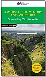
Wandelgids 21Somerset the Mendips Wiltshire Pathfinder Guide | Pathfinder Guide 21 | Met Ordanance Survey kaartenDeze Pathfinder Guide is een goed uitgevoerde gids met verschillende wandelingen in Groot-Britannië. De gids bevat naast goede topografische kaarten van de Britse topografische dienst (Ordanance Survey) ook beschrijvingen van het landschap, de cultuur en/of de flora en fauna. Verder is de gids voorzien van praktische informatie zoals startpunten, verwachte wandeltijd, restaurants en cafés voor onderweg. |
17,99 Tijdelijk niet leverbaar |
|
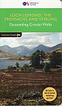
Wandelgids 23 Loch Lomond, The Trossachs and Stirling Pathfinder Guide | Pathfinder Guide 23 | Met Ordanance Survey kaartenDeze Pathfinder Guide is een goed uitgevoerde gids met verschillende wandelingen in Groot-Britannië. De gids bevat naast goede topografische kaarten van de Britse topografische dienst (Ordanance Survey) ook beschrijvingen van het landschap, de cultuur en/of de flora en fauna. Verder is de gids voorzien van praktische informatie zoals startpunten, verwachte wandeltijd, restaurants en cafés voor onderweg. Walking in Scotland is quite different from walking south of the border. In England there are only eight summits that top 3000 ft, while in Scotland there a... |
17,99 |
|
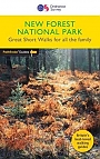
Wandelgids 23 New Forest NP Pathfinder Guide (Short Walks) | Korte wandelingen tot 7.5 kmDeze Pathfinder Guide is een goed uitgevoerde gids met verschillende wandelingen in Groot-Britannie. De gids bevat naast goede topografische kaarten van de Britse topografische dienst (Ordanance Survey) ook beschrijvingen van het landschap, de cultuur en/of de flora en fauna. Verder is de gids voorzien van praktische informatie zoals startpunten, verwachte wandeltijd, restaurants en cafes voor onderweg. This book has 20 short walks from 1.5 to 5.5 miles in length exploring the New Forest National Park. Each walk includes turn by turn directions, information on parking ... |
11,50 |
|
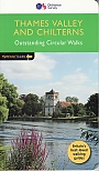
Wandelgids 25 Thames Valley and Chilterns Pathfinder Guide | Pathfinder Guide 25 | Met Ordanance Survey kaartenDeze Pathfinder Guide is een goed uitgevoerde gids met verschillende wandelingen in Groot-Britannië. De gids bevat naast goede topografische kaarten van de Britse topografische dienst (Ordanance Survey) ook beschrijvingen van het landschap, de cultuur en/of de flora en fauna. Verder is de gids voorzien van praktische informatie zoals startpunten, verwachte wandeltijd, restaurants en cafés voor onderweg. The Chilterns form part of the long line of chalk hills stretching intermittently across southern and eastern England. It is an area characterised by beech woods and ... |
17,99 |
|
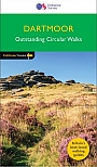
Wandelgids 26 Dartmoor Pathfinder Guide | Pathfinder Guide 26 | Met Ordanance Survey kaartenDeze Pathfinder Guide is een goed uitgevoerde gids met verschillende wandelingen in Groot-Britannië. De gids bevat naast goede topografische kaarten van de Britse topografische dienst (Ordanance Survey) ook beschrijvingen van het landschap, de cultuur en/of de flora en fauna. Verder is de gids voorzien van praktische informatie zoals startpunten, verwachte wandeltijd, restaurants en cafes voor onderweg. Discover the rugged, iconic landscape of Dartmoor with this selection of 28 walks designed to help you find the best it has to offer. While largely uninhabited wil... |
17,99 |
|
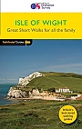
Wandelgids 27 Isle of Wight Pathfinder Guide (Short Walks) | Pathfinder Guide 27 | Met Ordanance Survey kaartenDeze Pathfinder Guide is een goed uitgevoerde gids met verschillende wandelingen in Groot-Britannië. De gids bevat naast goede topografische kaarten van de Britse topografische dienst (Ordanance Survey) ook beschrijvingen van het landschap, de cultuur en/of de flora en fauna. Verder is de gids voorzien van praktische informatie zoals startpunten, verwachte wandeltijd, restaurants en cafés voor onderweg. Short Walks Isle of Wight covering parts of Newtown, Tennyson Down and Bembridge.This selection offers interest and regional variety in the Isle of Wight, p... |
11,50 |
|
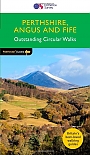
Wandelgids 27 Perthshire, Angus & Fife Pathfinder Guide | Pathfinder Guide 27 | Met Ordanance Survey kaartenDeze Pathfinder Guide is een goed uitgevoerde gids met verschillende wandelingen in Groot-Britannië. De gids bevat naast goede topografische kaarten van de Britse topografische dienst (Ordanance Survey) ook beschrijvingen van het landschap, de cultuur en/of de flora en fauna. Verder is de gids voorzien van praktische informatie zoals startpunten, verwachte wandeltijd, restaurants en cafes voor onderweg. Each of the Jarrold Pathfinder titles features 28 circular routes, all tried and tested by seasoned walkers. The routes range from extended strolls to exhilarating... |
17,99 |
|
Wandelgids 28 North York Moors Pathfinder Guide | Pathfinder Guide 28 | Met Ordanance Survey kaartenDeze Pathfinder Guide is een goed uitgevoerde gids met verschillende wandelingen in Groot-Britannië. De gids bevat naast goede topografische kaarten van de Britse topografische dienst (Ordanance Survey) ook beschrijvingen van het landschap, de cultuur en/of de flora en fauna. Verder is de gids voorzien van praktische informatie zoals startpunten, verwachte wandeltijd, restaurants en cafés voor onderweg. A total of 175 miles of superb walking in the North York Moors National Park. |
17,99 |

|
Wandelgids 29 Devon South Pathfinder Guide (Short Walks) | Pathfinder Guide 29 | Met Ordanance Survey kaartenDeze Pathfinder Guide is een goed uitgevoerde gids met verschillende wandelingen in Groot-Britannië. De gids bevat naast goede topografische kaarten van de Britse topografische dienst (Ordanance Survey) ook beschrijvingen van het landschap, de cultuur en/of de flora en fauna. Verder is de gids voorzien van praktische informatie zoals startpunten, verwachte wandeltijd, restaurants en cafés voor onderweg. South Devon is famed above all for its magnificent rugged coast, stretching from Plymouth in the west to Seaton in the east, a coastline of imposing sandsto... |
11,50 |

|
Wandelgids 29 Wye Valley & Forrest of Dean Pathfinder Guide | Pathfinder Guide 29 | Met Ordanance Survey kaartenDeze Pathfinder Guide is een goed uitgevoerde gids met verschillende wandelingen in Groot-Britannië. De gids bevat naast goede topografische kaarten van de Britse topografische dienst (Ordanance Survey) ook beschrijvingen van het landschap, de cultuur en/of de flora en fauna. Verder is de gids voorzien van praktische informatie zoals startpunten, verwachte wandeltijd, restaurants en cafes voor onderweg. 28 wandelingen. The Wye Valley and Forest of Dean Pathfinder guidebook contains 28 circular walks for all abilities. Walks are from 4km to 17km long, and each rout... |
17,99 |
|
Wandelgids 30 Loch Ness & Iverness Pathfinder Guide | Pathfinder Guide 30 | Met Ordanance Survey kaartenDeze Pathfinder Guide is een goed uitgevoerde gids met verschillende wandelingen in Groot-Britannië. De gids bevat naast goede topografische kaarten van de Britse topografische dienst (Ordanance Survey) ook beschrijvingen van het landschap, de cultuur en/of de flora en fauna. Verder is de gids voorzien van praktische informatie zoals startpunten, verwachte wandeltijd, restaurants en cafes voor onderweg. 28 wandelingen. Discover the Highland 'capital' of Inverness, the dramatic shore of Loch Ness, Ben Wyvis and much more with this Pathfinder walking guidebo... |
17,99 |
|
Wandelgids 32 Wales North & Snowdonia Pathfinder Guide | Pathfinder Guide 32 | Met Ordanance Survey kaartenDeze Pathfinder Guide is een goed uitgevoerde gids met verschillende wandelingen in Groot-Britannie. De gids bevat naast goede topografische kaarten van de Britse topografische dienst (Ordanance Survey) ook beschrijvingen van het landschap, de cultuur en/of de flora en fauna. Verder is de gids voorzien van praktische informatie zoals startpunten, verwachte wandeltijd, restaurants en cafes voor onderweg. 28 wandelingen. Discover far more than Wales' highest mountain with the Pathfinder guidebook for North Wales and Snowdonia. Routes include Great Orme, Tal Y Fan, th... |
17,99 Tijdelijk niet leverbaar |
|
Wandelgids 34 Pembrokeshire and Carmarthenshire Pathfinder Guide | Pathfinder Guide 34 | Met Ordanance Survey kaartenDeze Pathfinder Guide is een goed uitgevoerde gids met verschillende wandelingen in Groot-Britannië. De gids bevat naast goede topografische kaarten van de Britse topografische dienst (Ordanance Survey) ook beschrijvingen van het landschap, de cultuur en/of de flora en fauna. Verder is de gids voorzien van praktische informatie zoals startpunten, verwachte wandeltijd, restaurants en cafés voor onderweg. Although deep in South Wales, Pembrokeshire and Carmarthenshire have a strong English influence, but their most striking feature, from the point of view of ... |
17,99 Tijdelijk niet leverbaar |
|
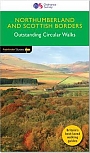
Wandelgids 35 Northumberland & the Scottish Borders Pathfinder Guide | Pathfinder Guide 35 | Met Ordanance Survey kaartenDeze Pathfinder Guide is een goed uitgevoerde gids met verschillende wandelingen in Groot-Britannie. De gids bevat naast goede topografische kaarten van de Britse topografische dienst (Ordanance Survey) ook beschrijvingen van het landschap, de cultuur en/of de flora en fauna. Verder is de gids voorzien van praktische informatie zoals startpunten, verwachte wandeltijd, restaurants en cafes voor onderweg. 28 wandelingen. Pathfinder(R) Northumberland and the Scottish Borders covering Blanchland, Melrose and Hartside. This selection offers interest, regional variety and ba... |
17,99 |
|
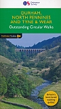
Wandelgids 39 Durham, North Pennines & Tyne & Wear Pathfinder Guide | Pathfinder Guide 39 | Met Ordanance Survey kaartenDeze Pathfinder Guide is een goed uitgevoerde gids met verschillende wandelingen in Groot-Britannie. De gids bevat naast goede topografische kaarten van de Britse topografische dienst (Ordanance Survey) ook beschrijvingen van het landschap, de cultuur en/of de flora en fauna. Verder is de gids voorzien van praktische informatie zoals startpunten, verwachte wandeltijd, restaurants en cafes voor onderweg. 28 dagwandelingen. This Pathfinder walking guide covers both the Cumbrian and Durham sides of the North Pennines, a designated Area of Outstanding Beauty, and also exte... |
17,99 |
|
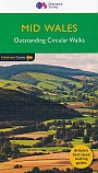
Wandelgids 41 Mid Wales Pathfinder Guide | Pathfinder Guide 41 | Met Ordanance Survey kaartenDeze Pathfinder Guide is een goed uitgevoerde gids met verschillende wandelingen in Groot-Britannie. De gids bevat naast goede topografische kaarten van de Britse topografische dienst (Ordanance Survey) ook beschrijvingen van het landschap, de cultuur en/of de flora en fauna. Verder is de gids voorzien van praktische informatie zoals startpunten, verwachte wandeltijd, restaurants en cafes voor onderweg. 28 dagwandelingen. Explore Mid Wales over 28 walks with this walking guidebook from the Pathfinder series. Each walk is listed by distance and difficulty, and range fro... |
17,99 |
|
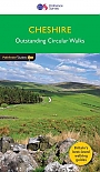
Wandelgids 42 Cheshire Pathfinder Guide | Pathfinder Guide 42 | Met Ordanance Survey kaartenDeze Pathfinder Guide is een goed uitgevoerde gids met verschillende wandelingen in Groot-Britannie. De gids bevat naast goede topografische kaarten van de Britse topografische dienst (Ordanance Survey) ook beschrijvingen van het landschap, de cultuur en/of de flora en fauna. Verder is de gids voorzien van praktische informatie zoals startpunten, verwachte wandeltijd, restaurants en cafes voor onderweg. 28 dagwandelingen. This walking guidebook for Cheshire contains 28 outstanding walks all tried and tested by experienced walkers. The routes range from extended strolls... |
17,99 |
|
Wandelgids 45 Norfolk Pathfinder Guide | Pathfinder Guide 45 | Met Ordanance Survey kaartenDeze Pathfinder Guide is een goed uitgevoerde gids met verschillende wandelingen in Groot-Britannië. De gids bevat naast goede topografische kaarten van de Britse topografische dienst (Ordanance Survey) ook beschrijvingen van het landschap, de cultuur en/of de flora en fauna. Verder is de gids voorzien van praktische informatie zoals startpunten, verwachte wandeltijd, restaurants en cafés voor onderweg. This selection offers interest, regional variety and a balance of routes in Norfolk providing the best walks in the area. |
17,99 Tijdelijk niet leverbaar |
|
Wandelgids 46 Aberdeen / Royal Deeside Pathfinder Guide | Pathfinder Guide 46 | Met Ordanance Survey kaartenDeze Pathfinder Guide is een goed uitgevoerde gids met verschillende wandelingen in Groot-Britannie. De gids bevat naast goede topografische kaarten van de Britse topografische dienst (Ordanance Survey) ook beschrijvingen van het landschap, de cultuur en/of de flora en fauna. Verder is de gids voorzien van praktische informatie zoals startpunten, verwachte wandeltijd, restaurants en cafes voor onderweg. The Aberdeen and Grampian Tourist Board describes the area as 'Royal Deeside, Whisky, Castles and Coast' and it is easy to see why. The royal connection is most obvious... |
17,99 Tijdelijk niet leverbaar |
|
Wandelgids 47 Brecon Beacons Pathfinder Guide (Short Walks) | 20 korte wandelingen 7.5 kmDeze Pathfinder Guide is een goed uitgevoerde gids met verschillende wandelingen in Groot-Britannie. De gids bevat naast goede topografische kaarten van de Britse topografische dienst (Ordanance Survey) ook beschrijvingen van het landschap, de cultuur en/of de flora en fauna. Verder is de gids voorzien van praktische informatie zoals startpunten, verwachte wandeltijd, restaurants en cafes voor onderweg. Short Walks Brecon Beacons covering parts of The Sugar Loaf, Pen y Fan and Llyn y Fan Fach. This selection offers interest and regional variety in the Brecon Beacons, p... |
11,50 Tijdelijk niet leverbaar |
|
Wandelgids 47 Edinburgh, Pentlands & the Lothians Pathfinder Guide | Pathfinder Guide 47 | Met Ordanance Survey kaartenDeze Pathfinder Guide is een goed uitgevoerde gids met verschillende wandelingen in Groot-Britannië. De gids bevat naast goede topografische kaarten van de Britse topografische dienst (Ordanance Survey) ook beschrijvingen van het landschap, de cultuur en/of de flora en fauna. Verder is de gids voorzien van praktische informatie zoals startpunten, verwachte wandeltijd, restaurants en cafes voor onderweg. This new edition of Pathfinder: Edinburgh, Pentlands & Lothians has been fully revised to include seven new walking routes, including a classic walk to the sum... |
17,99 |
|
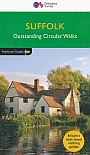
Wandelgids 48 Suffolk Pathfinder Guide | Pathfinder Guide 48 | Met Ordanance Survey kaartenDeze Pathfinder Guide is een goed uitgevoerde gids met verschillende wandelingen in Groot-Britannië. De gids bevat naast goede topografische kaarten van de Britse topografische dienst (Ordanance Survey) ook beschrijvingen van het landschap, de cultuur en/of de flora en fauna. Verder is de gids voorzien van praktische informatie zoals startpunten, verwachte wandeltijd, restaurants en cafés voor onderweg. Suffolk's riverside meadows of the Stour valley remain as beautiful today as when Constable painted them two centuries ago. Similarly, the county's lonely expanses... |
17,99 |
|
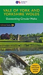
Wandelgids 49 Vale of York and the Yorkshire Wolds Pathfinder Guide | Pathfinder Guide 49 | Met Ordanance Survey kaartenDeze Pathfinder Guide is een goed uitgevoerde gids met verschillende wandelingen in Groot-Britannië. De gids bevat naast goede topografische kaarten van de Britse topografische dienst (Ordanance Survey) ook beschrijvingen van het landschap, de cultuur en/of de flora en fauna. Verder is de gids voorzien van praktische informatie zoals startpunten, verwachte wandeltijd, restaurants en cafés voor onderweg. 28 DAGWANDELINGEN. With 28 circular, graded walks all tried and tested by seasoned walkers, this guidebook for the Vale of York and the Yorkshire Wolds will help you ... |
17,99 Tijdelijk niet leverbaar |
|
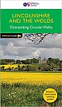
Wandelgids 50 Lincolnshire & the Wolds Pathfinder Guide | Pathfinder Guide 50 | Met Ordanance Survey kaartenDeze Pathfinder Guide is een goed uitgevoerde gids met verschillende wandelingen in Groot-Britannië. De gids bevat naast goede topografische kaarten van de Britse topografische dienst (Ordanance Survey) ook beschrijvingen van het landschap, de cultuur en/of de flora en fauna. Verder is de gids voorzien van praktische informatie zoals startpunten, verwachte wandeltijd, restaurants en cafés voor onderweg. With 28 circular walks all tried and tested by seasoned walkers, this walking guidebook is ideal for both visitors and locals. The routes range from extended strolls ... |
17,99 Tijdelijk niet leverbaar |
|
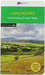
Wandelgids 53 Lancashire Pathfinder Guide | Pathfinder Guide 53 | Met Ordanance Survey kaartenDeze Pathfinder Guide is een goed uitgevoerde gids met verschillende wandelingen in Groot-Britannië. De gids bevat naast goede topografische kaarten van de Britse topografische dienst (Ordanance Survey) ook beschrijvingen van het landschap, de cultuur en/of de flora en fauna. Verder is de gids voorzien van praktische informatie zoals startpunten, verwachte wandeltijd, restaurants en cafes voor onderweg. With its fen-like lowlands, its coastal scenery, the high fells of Bowland and the lush river valleys of the Ribble and Lune, Lancashire is a county of surprising ... |
17,99 |
|
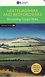
Wandelgids 54 Hertfordshire and Bedfordshire Pathfinder Guide | Pathfinder Guide 54 | Met Ordanance Survey kaartenDeze Pathfinder Guide is een goed uitgevoerde gids met verschillende wandelingen in Groot-Britannië. De gids bevat naast goede topografische kaarten van de Britse topografische dienst (Ordanance Survey) ook beschrijvingen van het landschap, de cultuur en/of de flora en fauna. Verder is de gids voorzien van praktische informatie zoals startpunten, verwachte wandeltijd, restaurants en cafés voor onderweg 28 great country walks from 3 to 10 1/2 miles with lage scale OS maps. |
17,99 |
|
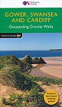
Wandelgids 55 Gower / Swansea / Cardiff Pathfinder Guide | Pathfinder Guide 55 | Met Ordanance Survey kaartenDeze Pathfinder Guide is een goed uitgevoerde gids met verschillende wandelingen in Groot-Britannie. De gids bevat naast goede topografische kaarten van de Britse topografische dienst (Ordanance Survey) ook beschrijvingen van het landschap, de cultuur en/of de flora en fauna. Verder is de gids voorzien van praktische informatie zoals startpunten, verwachte wandeltijd, restaurants en cafes voor onderweg. 28 wandelingen. |
17,99 Tijdelijk niet leverbaar |
|
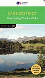
Wandelgids 60 Lake District Pathfinder Guide | Pathfinder Guide 60 | Met Ordanance Survey kaartenDeze Pathfinder Guide is een goed uitgevoerde gids met verschillende wandelingen in Groot-Britannië. De gids bevat naast goede topografische kaarten van de Britse topografische dienst (Ordanance Survey) ook beschrijvingen van het landschap, de cultuur en/of de flora en fauna. Verder is de gids voorzien van praktische informatie zoals startpunten, verwachte wandeltijd, restaurants en cafés voor onderweg. Pathfinder Lake District covering Coniston, Kewswick and Devoke Water. This selection offers interest, regional variety and balance of routes in the Lake Di... |
17,99 |