- Gratis verzending vanaf 30 euro
- Levert in Nederland, België etc.
- Meer dan 30.000 titels
- Vakkundige klantenservice
- Snelle levering
- Veilig en eenvoudig betalen

Direct contact?
Bel +31 (0)6 42428571
maandag t/m vrijdag
van 10 tot 17 uur
Europa / Groot-Brittannië / Engeland
Engeland bestsellers
|
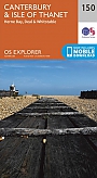
Topografische Wandelkaart 150 Canterbury / Isle of Thanet - Explorer Map | Wandelkaart & Fietskaart | Ordnance Survey (OS) Groot-BrittanniëDeze gedetailleerde en informatieve topografische kaart (stafkaart, schaal 1:25.000) van Groot-Brittannië bevat alle topografische elementen van het landschap en geeft daarmee een nauwkeurig beeld van het terrein. Daarnaast heeft Ordnance Survey (OS) ook toeristische informatie op de meeste kaart verwerkt, zoals de aanduiding voor campings en ingetekende wandelpaden . Deze kaart is ideaal voor wandelaars of fietsers, maar ook voor de scouting of sportverenigingen die activiteiten in Groot-Brittannië gaan uitvoeren. De kaarten zijn voorzien van een GPS aanduiding en e... Schaal: 1:25.000 |
18,99 |
|
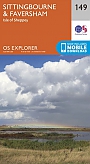
Topografische Wandelkaart 149 Sittingbourne / Faversham Isle of Sheppey - Explorer Map | Wandelkaart & Fietskaart | Ordnance Survey (OS) Groot-BrittanniëDeze gedetailleerde en informatieve topografische kaart (stafkaart, schaal 1:25.000) van Groot-Brittannië bevat alle topografische elementen van het landschap en geeft daarmee een nauwkeurig beeld van het terrein. Daarnaast heeft Ordnance Survey (OS) ook toeristische informatie op de meeste kaart verwerkt, zoals de aanduiding voor campings en ingetekende wandelpaden . Deze kaart is ideaal voor wandelaars of fietsers, maar ook voor de scouting of sportverenigingen die activiteiten in Groot-Brittannië gaan uitvoeren. De kaarten zijn voorzien van een GPS aanduiding en e... Schaal: 1:25.000 |
18,99 |
|
Topografische Wandelkaart 148 Maidstone / Medway Towns - Explorer Map | Wandelkaart & Fietskaart | Ordnance Survey (OS) Groot-BrittanniëDeze gedetailleerde en informatieve topografische kaart (stafkaart, schaal 1:25.000) van Groot-Brittannië bevat alle topografische elementen van het landschap en geeft daarmee een nauwkeurig beeld van het terrein. Daarnaast heeft Ordnance Survey (OS) ook toeristische informatie op de meeste kaart verwerkt, zoals de aanduiding voor campings en ingetekende wandelpaden . Deze kaart is ideaal voor wandelaars of fietsers, maar ook voor de scouting of sportverenigingen die activiteiten in Groot-Brittannië gaan uitvoeren. De kaarten zijn voorzien van een GPS aanduiding en e... Schaal: 1:25.000 |
18,99 |
|
Topografische Wandelkaart 147 Sevenoaks / Tonbridge - Explorer Map | Wandelkaart & Fietskaart | Ordnance Survey (OS) Groot-BrittanniëDeze gedetailleerde en informatieve topografische kaart (stafkaart, schaal 1:25.000) van Groot-Brittannië bevat alle topografische elementen van het landschap en geeft daarmee een nauwkeurig beeld van het terrein. Daarnaast heeft Ordnance Survey (OS) ook toeristische informatie op de meeste kaart verwerkt, zoals de aanduiding voor campings en ingetekende wandelpaden . Deze kaart is ideaal voor wandelaars of fietsers, maar ook voor de scouting of sportverenigingen die activiteiten in Groot-Brittannië gaan uitvoeren. De kaarten zijn voorzien van een GPS aanduiding en e... Schaal: 1:25.000 |
18,99 |

|
Topografische Wandelkaart 146 Dorking / Box Hill / Reigate - Explorer Map | Wandelkaart & Fietskaart | Ordnance Survey (OS) Groot-BrittanniëDeze gedetailleerde en informatieve topografische kaart (stafkaart, schaal 1:25.000) van Groot-Brittannië bevat alle topografische elementen van het landschap en geeft daarmee een nauwkeurig beeld van het terrein. Daarnaast heeft Ordnance Survey (OS) ook toeristische informatie op de meeste kaart verwerkt, zoals de aanduiding voor campings en ingetekende wandelpaden . Deze kaart is ideaal voor wandelaars of fietsers, maar ook voor de scouting of sportverenigingen die activiteiten in Groot-Brittannië gaan uitvoeren. De kaarten zijn voorzien van een GPS aanduiding en e... Schaal: 1:25.000 |
18,99 |
|
Topografische Wandelkaart 145 Guildford / Farnham - Explorer Map | Wandelkaart & Fietskaart | Ordnance Survey (OS) Groot-BrittanniëDeze gedetailleerde en informatieve topografische kaart (stafkaart, schaal 1:25.000) van Groot-Brittannië bevat alle topografische elementen van het landschap en geeft daarmee een nauwkeurig beeld van het terrein. Daarnaast heeft Ordnance Survey (OS) ook toeristische informatie op de meeste kaart verwerkt, zoals de aanduiding voor campings en ingetekende wandelpaden . Deze kaart is ideaal voor wandelaars of fietsers, maar ook voor de scouting of sportverenigingen die activiteiten in Groot-Brittannië gaan uitvoeren. De kaarten zijn voorzien van een GPS aanduiding en e... Schaal: 1:25.000 |
18,99 |
|
Wandelgids 39 Durham, North Pennines & Tyne & Wear Pathfinder Guide | Pathfinder Guide 39 | Met Ordanance Survey kaartenDeze Pathfinder Guide is een goed uitgevoerde gids met verschillende wandelingen in Groot-Britannie. De gids bevat naast goede topografische kaarten van de Britse topografische dienst (Ordanance Survey) ook beschrijvingen van het landschap, de cultuur en/of de flora en fauna. Verder is de gids voorzien van praktische informatie zoals startpunten, verwachte wandeltijd, restaurants en cafes voor onderweg. 28 dagwandelingen. This Pathfinder walking guide covers both the Cumbrian and Durham sides of the North Pennines, a designated Area of Outstanding Beauty, and also exte... |
17,99 |
|
Fietskaart NN24 Bath to Bournemouth Cycle Map SustransSustrans kaarten geven een goed overzicht van het National Cycle Network. 25.000 km lang is het fietsnetwerk inmiddels. De routes zijn bewegwijzerd, autoluw en fietsvriendelijk. Oude spoorwegen zijn omgetoverd in fietspaden of er wordt gebruik gemaakt van jaagpaden langs waterwegen. De cartografie is duidelijk met veel praktische informatie. The official route map for the 85-mile (137km) ride from Bath to Bournemouth. This linear map shows the route and immediate surrounding area over a series of separate map panels. The full colour map based on Ordnance Survey ... Schaal: 1:110.000 |
13,50 |

|
Topografische Wandelkaart OL3 van Groot-Brittannië (1:25.000) Meon Valley - Portsmouth Gosport & - Explorer Map OL 3 | Wandelkaart | Ordnance Survey (OS) Groot-BrittanniëDeze gedetailleerde en informatieve topografische kaart (stafkaart, schaal 1:25.000) van Groot-Brittannië bevat alle topografische elementen van het landschap en geeft daarmee een nauwkeurig beeld van het terrein. Daarnaast heeft Ordnance Survey (OS) ook toeristische informatie op de meeste kaart verwerkt, zoals de aanduiding voor campings en ingetekende wandelpaden . Deze kaart is ideaal voor wandelaars of fietsers, maar ook voor de scouting of sportverenigingen die activiteiten in Groot-Brittannië gaan uitvoeren. De kaarten zijn voorzien van een GPS aanduiding en e... Schaal: 1:25.000 |
18,99 |
|
Wandelgids 74 Malverns to Warwickshire Pathfinder Guide | Pathfinder Guide 01 | Met Ordanance Survey kaartenDeze Pathfinder Guide is een goed uitgevoerde gids met verschillende wandelingen in Groot-Britannië. De gids bevat naast goede topografische kaarten van de Britse topografische dienst (Ordanance Survey) ook beschrijvingen van het landschap, de cultuur en/of de flora en fauna. Verder is de gids voorzien van praktische informatie zoals startpunten, verwachte wandeltijd, restaurants en cafés voor onderweg. The area covered by this guide encompasses all the scenic features that are generally considered to be traditionally English. It is a landscape characterised by gentl... |
17,95 Tijdelijk niet leverbaar |

|
Reisgids Slow Northumberland Bradt Travel GuidePrima reishandboek met veel praktische informatie: overnachtingsmogelijkheden, transport, eetgelegenheden, plattegrondjes, backpack informatie, suggesties voor een actieve vakantie. Betrouwbare achtergrond informatie over cultuur, land en bevolking. Met deze gids kun je van de platgetreden paden af en het avontuur tegemoet. Een geschikte gids voor toeristen luw gebied. |
17,99 Tijdelijk niet leverbaar |
|
Wandelgids 50 Walks in the Peak District | AA PublishingOverzichtelijke wandelgids met duidelijke beschrijvingen en wandelkaarten. Wandeltochten van 5 tot 13 kilometer. Featuring all the practical detail you need, accompanied by fascinating background reading on the history and wildlife of the area with clear mapping for ease of use. Every route has been colour coded according to difficulty. All walks are annotated with local points of interest and places to stop for refreshments. |
18,99 |
|
Topografische Wandelkaart 282 Lincolnshire Wolds North Louth & Market Rasen - Explorer Map | Wandelkaart & Fietskaart | Ordnance Survey (OS) Groot-BrittanniëDeze gedetailleerde en informatieve topografische kaart (stafkaart, schaal 1:25.000) van Groot-Brittannië bevat alle topografische elementen van het landschap en geeft daarmee een nauwkeurig beeld van het terrein. Daarnaast heeft Ordnance Survey (OS) ook toeristische informatie op de meeste kaart verwerkt, zoals de aanduiding voor campings en ingetekende wandelpaden . Deze kaart is ideaal voor wandelaars of fietsers, maar ook voor de scouting of sportverenigingen die activiteiten in Groot-Brittannië gaan uitvoeren. De kaarten zijn voorzien van een GPS aanduiding en e... Schaal: 1:25.000 |
18,99 Tijdelijk niet leverbaar |
|
Fietskaart 16 Engeland Warwickshire & the South Midlands Cycle Map Sustrans Pocket SizedThis area map shows the National Cycle Network and local routes in this area. It covers the Warwickshire & South Midlands area of the Midlands region of England, including Warwick, Coventry, Rugby, Northampton and Kettering. This pocket-sized colour map shows clearly mapped on-road and traffic-free paths, easy to read contours, and detailed inset maps for the major towns and cities as well as recommended linking routes connecting the NCN with quiet roads. The map also features 5 day rides with directions and a description of the area, highlighting key cycle routes,... Schaal: 1:110.000 |
10,99 |
|
Wandelgids 50 Walks in Yorkshire Dales | AA PublishingOverzichtelijke wandelgids met duidelijke beschrijvingen en wandelkaarten. Wandeltochten van 5 tot 13 kilometer. The books feature all the practical detail you need, accompanied by fascinating background reading on the history and wildlife of the area, and clear mapping for ease of use. Every route has been colour coded according to difficulty. All walks are annotated with local points of interest and places to stop for refreshments. |
18,99 Tijdelijk niet leverbaar |

|
Stadsplattegrond Liverpool Pocket Map - Freytag & Berndt | Water- en scheurvaste stadsplattegrondEen overzichtelijke stadsplattegrond met stratenindex (achterzijde) en aanduiding van toeristische informatie en culturele instellingen zoals musea, monumenten, schouwburgen en sportaccomodaties. Daarnaast bevaten de meeste kaarten een heldere aanduiding van het openbaarvervoer (opstappunten van bijvoorbeeld de metro, tram of bus), parkeergelegenheden, postkantoren en andere praktische informatie. Schaal: 1:10.000 |
8,50 |
|
Fietskaart 13 East Anglia The Norfolk Broads Cycle Maps UK | Cordee | Water- en scheurvaste wandelkaart
Schaal: 1:100.000 |
13,95 |
|
Fietskaart 18 Peak District Cycle Maps UK | Cordee | Water- en scheurvaste fietskaart
Schaal: 1:100.000 |
13,95 |

|
Topografische Wandelkaart 281 Ancholme Valley Barton-upon-Humber, Brigg, Scunthorpe & Kirton in Lindsey - Explorer Map | Wandelkaart & Fietskaart | Ordnance Survey (OS) Groot-BrittanniëDeze gedetailleerde en informatieve topografische kaart (stafkaart, schaal 1:25.000) van Groot-Brittannië bevat alle topografische elementen van het landschap en geeft daarmee een nauwkeurig beeld van het terrein. Daarnaast heeft Ordnance Survey (OS) ook toeristische informatie op de meeste kaart verwerkt, zoals de aanduiding voor campings en ingetekende wandelpaden . Deze kaart is ideaal voor wandelaars of fietsers, maar ook voor de scouting of sportverenigingen die activiteiten in Groot-Brittannië gaan uitvoeren. De kaarten zijn voorzien van een GPS aanduiding en e... Schaal: 1:25.000 |
18,99 Tijdelijk niet leverbaar |
|
Wandelgids 23 New Forest NP Pathfinder Guide (Short Walks) | Korte wandelingen tot 7.5 kmDeze Pathfinder Guide is een goed uitgevoerde gids met verschillende wandelingen in Groot-Britannie. De gids bevat naast goede topografische kaarten van de Britse topografische dienst (Ordanance Survey) ook beschrijvingen van het landschap, de cultuur en/of de flora en fauna. Verder is de gids voorzien van praktische informatie zoals startpunten, verwachte wandeltijd, restaurants en cafes voor onderweg. This book has 20 short walks from 1.5 to 5.5 miles in length exploring the New Forest National Park. Each walk includes turn by turn directions, information on parking ... |
11,50 |
|
Reisgids Slow Norfolk Bradt Travel Guide | Local, Characterful Guides To Britain's Special PlacesThis new, thoroughly updated, third edition of Bradt's Norfolk, part of Bradt's award-winning 'Slow travel' series of guides to UK regions, turns the spotlight on this county of contrasts, from the fine city of Norwich to the watery wilderness of the Broads and the sweeping beaches of the superlative north coast. As well as featuring all the main sights, experienced travel writer and local resident Laurence Mitchell ensures that Bradt's Norfolk covers places and aspects not detailed by other guidebooks and offers a special emphasis on car-free trave... |
21,50 |

|
Reisgids Slow North York Moors & Yorkshire Wolds Bradt Travel Guide | Moors, Dales And Coast, Including Yorklocal, Characterful GuidesThis new, thoroughly updated second edition of Bradt's North York Moors and Yorkshire Wolds, part of the distinctive 'Slow travel' series of guides to UK regions, remains the only full-blown standalone guide available to this region of contrasts, from the magnificent cliffs and beaches of the Heritage Coast and rolling hills of the North York Moors to the tranquil chalk downland of the Wolds. Nestled at the heart of it all is the ancient historic city of York, with its stunning Minster, the largest Gothic cathedral in Northern Europe. As well as featuring a... |
21,90 |
|
Wandelgids North Downs Way | Trailblazer | 80 Large-Scale Walking Maps & Guides to 45 Towns & Villages - Planning, Places to Stay, PlacesPractical guide to walking the North Downs Way National Trail that runs from Farnham in Surrey to Dover in Kent, partly following the old Pilgrims' Way to the shrine of St Thomas a Becket at Canterbury. It winds its way through the protected landscape of the Surrey Hills and the Kent Downs, passing medieval churches, castles, Neolithic burial sites, vineyards and numerous WWII defences. There are literary associations with Swift, Cobbett, Dickens and Jane Austen. The guide includes: * 80 large-scale walking maps - at just under 1:20,000 - showing route times, place... |
16,99 |
|
Wandelgids Hadrian's Wall Path Rucksack ReadersRucksack Readers zijn handig uitgevoerd in een klapper met ringband. Deze gids heeft een goede beschrijving van de lange afstands route met overzichtelijke kaarten doch zonder veel detail. De kracht van de Rucksack Readers is de uitgebreide achtergrondinformatie over de flora, fauna en geologische verschijnselen. Dit alles rijkelijk omkleed met kleurrijke foto's en praktische tips. Hadrian’s Wall Path runs for 86 miles (138 km) between Bowness-on-Solway and Wallsend (Newcastle) along the line of the Roman Wall completed in AD122 under the Emperor Hadrian. Thi... |
17,50 |

|
Wandelgids South Downs Way Rucksack ReadersRucksack Readers zijn handig uitgevoerd in een klapper met ringband. Deze gids heeft een goede beschrijving van de lange afstands route met overzichtelijke kaarten doch zonder veel detail. De kracht van de Rucksack Readers is de uitgebreide achtergrondinformatie over de flora, fauna en geologische verschijnselen. Dit alles rijkelijk omkleed met kleurrijke foto's en praktische tips. The South Downs Way is one of England’s popular National Trails. It runs for 100 miles (160 km) from the cathedral city of Winchester to the spectacular white cliffs of East Sussex, fi... |
15,99 |
|
Wandelkaartgids The North Downs Way Booklet | Cicerone | National trail from Farnham to DoverHandzaam kaartgidsje. Gedetailleerde topografische wandelkaarten gebonden in een handig boekje. Licht voor onderweg. Map of the 130 mile (208km) North Downs Way National Trail, between Farnham and Dover, including an optional visit to Canterbury. This booklet is included with the Cicerone guidebook to the trail and shows the full route on OS 1:25,000 maps. One of the easier National Trails, it can be comfortably walked in 11-12 days. Schaal: 1:25.000 |
13,99 |
|
Topografische Wandelkaart 280 Isle of Axholme Scunthorpe & Gainsborough - Explorer Map | Wandelkaart & Fietskaart | Ordnance Survey (OS) Groot-BrittanniëDeze gedetailleerde en informatieve topografische kaart (stafkaart, schaal 1:25.000) van Groot-Brittannië bevat alle topografische elementen van het landschap en geeft daarmee een nauwkeurig beeld van het terrein. Daarnaast heeft Ordnance Survey (OS) ook toeristische informatie op de meeste kaart verwerkt, zoals de aanduiding voor campings en ingetekende wandelpaden . Deze kaart is ideaal voor wandelaars of fietsers, maar ook voor de scouting of sportverenigingen die activiteiten in Groot-Brittannië gaan uitvoeren. De kaarten zijn voorzien van een GPS aanduiding en e... Schaal: 1:25.000 |
18,99 Tijdelijk niet leverbaar |
|
Topografische Wandelkaart OL21 van Groot-Brittannië (1:25.000) South Pennines - Explorer Map OL 21 | Wandelkaart | Ordnance Survey (OS) Groot-BrittanniëDeze gedetailleerde en informatieve topografische kaart (stafkaart, schaal 1:25.000) van Groot-Brittannie bevat alle topografische elementen van het landschap en geeft daarmee een nauwkeurig beeld van het terrein. Daarnaast heeft Ordnance Survey (OS) ook toeristische informatie op de meeste kaart verwerkt, zoals de aanduiding voor campings en ingetekende wandelpaden . Deze kaart is ideaal voor wandelaars of fietsers, maar ook voor de scouting of sportverenigingen die activiteiten in Groot-Brittanni« gaan uitvoeren. De kaarten zijn voorzien van een GPS aanduiding en ... Schaal: 1:25.000 |
18,99 |
|
Topografische Wandelkaart OL29 van Groot-Brittannië (1:25.000) Isle of Wight - Explorer Map OL 29 | Wandelkaart | Ordnance Survey (OS) Groot-BrittanniëDeze gedetailleerde en informatieve topografische kaart (stafkaart, schaal 1:25.000) van Groot-Brittannië bevat alle topografische elementen van het landschap en geeft daarmee een nauwkeurig beeld van het terrein. Daarnaast heeft Ordnance Survey (OS) ook toeristische informatie op de meeste kaart verwerkt, zoals de aanduiding voor campings en ingetekende wandelpaden . Deze kaart is ideaal voor wandelaars of fietsers, maar ook voor de scouting of sportverenigingen die activiteiten in Groot-Brittannië gaan uitvoeren. De kaarten zijn voorzien van een GPS aanduiding en e... Schaal: 1:25.000 |
18,99 |
|
Topografische Wandelkaart OL1 van Groot-Brittannië (1:25.000) Peak District - Dark Peak area - Explorer Map OL 1 | Wandelkaart | Ordnance Survey (OS) Groot-BrittanniëDeze gedetailleerde en informatieve topografische kaart (stafkaart, schaal 1:25.000) van Groot-Brittannië bevat alle topografische elementen van het landschap en geeft daarmee een nauwkeurig beeld van het terrein. Daarnaast heeft Ordnance Survey (OS) ook toeristische informatie op de meeste kaart verwerkt, zoals de aanduiding voor campings en ingetekende wandelpaden . Deze kaart is ideaal voor wandelaars of fietsers, maar ook voor de scouting of sportverenigingen die activiteiten in Groot-Brittannië gaan uitvoeren. De kaarten zijn voorzien van een GPS aanduid... Schaal: 1:25.000 |
18,99 |
|
Wegenkaart - Landkaart 4 East Anglia - AA Road Map BritainOverzichtelijke wegenkaarten met een helder kaartbeeld. Wegnummers zijn weergegeven. Toerististische informatie door middel van pictogrammen. Campings, VVV, musea, grotten, picnic plekken, kastelen zijn onder andere aangegeven. Op de achterzijde staat een plaatsnamen register plus een aantal stadsplattegrondjes. Schaal: 1:200.000 |
8,99 |
|
Wandelkaart Pennine Way North: Greenhead to Kirk Yetholm - National Trail Maps | Harvey Maps | Water- en scheurvaste wandelkaartDe Harvey Map is de wandelkaart voor het lange afstand wandelpad in het Groot-Brittannië. Duidelijke topografische wandelkaarten met praktische informatie van de route zoals overnachtingsmogelijkheden, eetgelegenheden en bezienswaardigheden. Deze wandelkaart is scheur- en watervast. Met GPS compatible (UTM-Grid). The Pennine Way is a National Trail. It follows the backbone of England from the Peak District to the Scottish borders. It is one of the toughest UK long distance footpaths, and forms part of the European Footpath Network. Schaal: 1:40.000 |
25,99 |
|
Wandelkaart Ridgeway - National Trail Maps | Harvey Maps | Water- en scheurvaste wandelkaartDe Harvey Map is de wandelkaart voor het lange afstand wandelpad in het Groot-Brittannië. Duidelijke topografische wandelkaarten met praktische informatie van de route zoals overnachtingsmogelijkheden, eetgelegenheden en bezienswaardigheden. Deze wandelkaart is scheur- en watervast. Met GPS compatible (UTM-Grid). Compact and light - the map itself weighs just 60gms - a third of the weight of a laminated map, and much less bulky. And you can fold or refold it time and again, or stuff it in your back pocket and it won't fall to pieces. Schaal: 1:40.000 |
25,99 Tijdelijk niet leverbaar |
|
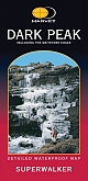
Wandelkaart Dark Peak - Walking Maps Superwalker | Harvey Maps | Water- en scheurvaste wandelkaartDe Harvey Map is de wandelkaart voor het wandelen in de mooiste natuurgebieden in het Groot-Brittannië. Duidelijke topografische wandelkaarten met praktische informatie van de route zoals overnachtingsmogelijkheden, eetgelegenheden en bezienswaardigheden. Deze wandelkaart is scheur- en watervast. Met GPS compatible (UTM-Grid). Detailed map for walking, scrambling and climbing Schaal: 1:25.000 |
17,99 |

|
Mountainbikekaart Peak District MTB map | GoldeneyeDe Goldeneye kaarten zijn uitstekende vrijetijdskaarten voor Groot-Brittannië, met name goed te gebruiken voor het fietsen door de overzichtelijke schaal. De De kaarten zijn helder, overzichtelijk en gedrukt op stevig papier. Deze Mountainbikekaarten zijn uniek voor Groot-Brittannië en bevatten paden die vrij liggen van drukke wegen en/of gemotoriseerd verkeer. Daarnaast bevat het ook ook de fietspaden van NCN (De Britse 'National Cycle Network') en andere fietspaden om je route vanuit een bepaald punt aan te kunnen fietsen. Een handig register met pl... Schaal: 1:37.700 |
12,50 |
|
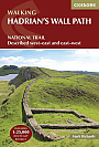
Wandelgids Hadrian's Wall Path Cicerone Guidebooks | National Trail Two-way national trail descriptionThe essential guidebook to walking the 84-mile Hadrian"s Wall Path. One of the UK's most visited National Trails, it runs the length of the Roman Wall from Bowness-on-Solway in Cumbria to Wallsend, Newcastle. Schaal: 1:25.000 |
22,99 |
|
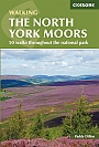
Wandelgids The North York Moors Cicerone Guidebooks | 50 walks throughout the National ParkThis guidebook offers 50 walks in seven regions throughout the North York Moors National Park, enabling walkers to discover and appreciate in turn the Tabular Hills, Hambleton Hills, Cleveland Hills, Northern Moors, High Moors, Eastern Moors and Cleveland Coast. For those walkers who like to rise to a challenge, the course of the classic Lyke Wake Walk is also offered, split over a four-day period to allow a more leisurely appreciation of the moors as it stretches across the national park from east to west. There are almost 750km (465 miles) of walking routes described... |
16,99 Tijdelijk niet leverbaar |
|
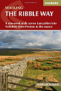
Wandelgids The Ribble Way Cicerone Guidebooks | A one-week walk across Lancashire into Yorkshire from Preston to the source
|
22,99 |
|
Wandelgids Coast to Coast Walk Cicerone Guidebooks | From St Bees Head in Cumbria to Robin Hood’s Bay on Yorkshire’sFirst devised by Alfred Wainwright, the Coast to Coast Walk has emerged as a favourite among long-distance walkers. The route stretches some 185 miles (296km) from St Bees, an historic seaside village on Cumbria's west coast to Robin Hood's Bay in North Yorkshire. It is suitable for most fit walkers and can be comfortably walked in around a fortnight. This guidebook presents the full route from west to east in 13 stages of 10 ½-20 ¾ miles (16.8-33.2km), with summaries covering the opposite direction. Alongside step-by-step route description... |
22,99 |
|
Wandelgids East White Peak Walks: Peak District Cicerone GuidebooksThis guidebook provides 35 day walks and 7 longer walks and trails exploring the eastern section of Derbyshire's limestone area. The walks are spread across the area, starting in pleasant towns and villages including Bakewell, Tissington, Eyam and Middleton. Largely travelling along well-marked paths over gentle rolling landscapes, these walks are suitable for walkers of all abilities. The day walks range between 4 and 12 miles in length, and are illustrated with extracts of 1:50,000 OS mapping, while the longer walks and trails are covered by 1:100,000 scal... |
16,99 |
|
Wandelgids Coast to Coast Rucksack ReadersRucksack Readers zijn handig uitgevoerd in een klapper met ringband. Deze gids heeft een goede beschrijving van de lange afstands route met overzichtelijke kaarten doch zonder veel detail. De kracht van de Rucksack Readers is de uitgebreide achtergrondinformatie over de flora, fauna en geologische verschijnselen. Dit alles rijkelijk omkleed met kleurrijke foto's en praktische tips. |
21,99 |
|
Wandelgids Coast to Coast path Two-way trekking guide | Knife Edge | St Bees to Robin Hood's BayThe definitive two-way guide to the Coast to Coast Path: both eastbound and westbound routes are described in full. |
20,99 |
|
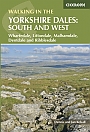
Wandelgids Walking in the Yorkshire Dales: South and West | Cicerone | Wharfedale, Littondale, Malhamdale, Dentdale and RibblesdaleThe Yorkshire Dales need little introduction: their picturesque scenery and hundreds of miles of footpaths, tracks and bridleways have been attracting walkers for decades. Part of a two-volume set, this guidebook presents over 40 routes in the south and west of the National Park, with bases including Sedburgh, Malham, Grassington, Skipton, Settle and Kirkby Lonsdale. The walks cover the valleys of Wharfedale, Littondale, Malhamdale, Ribblesdale and Dentdale – each with its own distinctive landscape and character. Also included is the Yorkshire Three Peaks, a 23 ... |
16,99 |
|
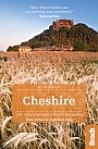
Reisgids Cheshire Slow Travel | Bradt TravelguideThis brand new title in Bradt's acclaimed UK regional Slow series is the only full guide to Cheshire, a county known for its abundance of black-and-white timbered buildings and which was put firmly on the map in the 1990s thanks to then-resident stars Posh and Becks. |
16,99 |
|
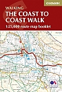
Wandelkaartgids The Coast to Coast map Booklet | CiceroneHandzaam kaartgidsje. Gedetailleerde topografische wandelkaarten gebonden in een handig boekje. Licht voor onderweg. Map of the 190 miles (300km) Coast to Coast Walk, between St Bees Head in Cumbria and Robin Hood's Bay in Yorkshire. This booklet is included with the Cicerone guidebook to the trail, and shows the full route on Ordnance Survey 1:25,000 maps. This popular long-distance route typically takes a fortnight to walk. Schaal: 1:25.000 |
14,99 |
|
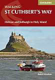
Wandelgids Walking St Cuthbert's Way | Cicerone | Melrose and Jedburgh to Holy IslandThis guidebook describes the long-distance trail of St Cuthbert's Way through Northumberland and the Borders. The route starts in Melrose and travels 100km (62 miles) through the Northumberland National Park to Holy Island. It also includes a description of the route from Holy Island up the coast to Berwick-upon-Tweed. |
21,99 |
|
Wandelgids 63 Peak District Pathfinder Guide | Pathfinder Guide 63 | Met Ordanance Survey kaartenDeze Pathfinder Guide is een goed uitgevoerde gids met verschillende wandelingen in Groot-Britannië. De gids bevat naast goede topografische kaarten van de Britse topografische dienst (Ordanance Survey) ook beschrijvingen van het landschap, de cultuur en/of de flora en fauna. Verder is de gids voorzien van praktische informatie zoals startpunten, verwachte wandeltijd, restaurants en cafés voor onderweg. 28 beautiful country walks around the Peak District, graded by length and ranging from 3 to 11 miles. All routes come with a clear, large-scale OS map, GPS ... |
17,99 |
|
Wandelgids Peddars Way and Norfolk Coast Path Trailblazer | Knettishall Heath to Cromer
|
21,50 |
|
Wandelgids Coast to Coast Path Trailblazer | St Bees to Robin Hood's Bay, Planning, Places to Stay
|
19,90 |

|
Reisgids Slow Sussex and The South Downs Bradt Travel GuideStraddling the Hampshire Downs and the distinctive countryside of Sussex, the South Downs is Britain's newest and most visited national park, and is abutted by a long coastline and the surprisingly remote landscapes of the Weald. Slow-travel enthusiast and Sussex resident Tim Locke takes a close-up look at the best of the countryside and places in his back yard, and celebrates what makes the area so distinctive. This is not a book of dry practicalities. Locke's local knowledge leads the reader to his favourite walks, pubs and and places to stay, while his colou... |
17,99 Tijdelijk niet leverbaar |