- Gratis verzending vanaf 30 euro
- Levert in Nederland, België etc.
- Meer dan 30.000 titels
- Vakkundige klantenservice
- Snelle levering
- Veilig en eenvoudig betalen

Direct contact?
Bel +31 (0)6 42428571
maandag t/m vrijdag
van 10 tot 17 uur
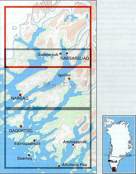
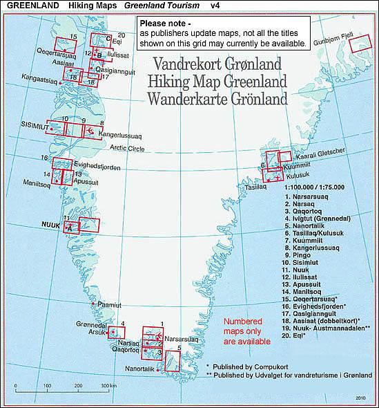
Wandelkaart Groenland 1 Narsarsuaq Hiking Map Greenland Harvey Maps
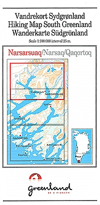
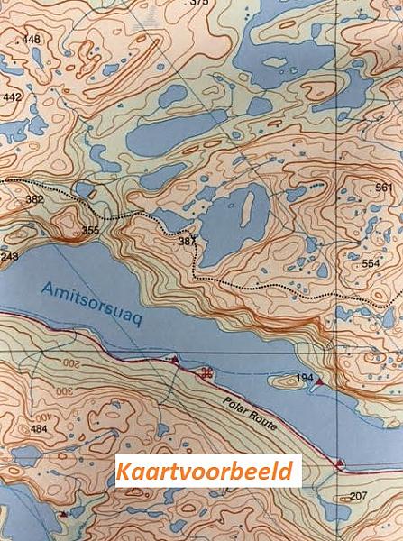
Narsarsuaq - Narsaq - Qaqortog, map no. 1, in a series of waterproof and tear-resistant topographic maps of popular coastal areas of southern and central Greenland. Countours are shown at 25-metre intervals, with additional altitude colouring. The maps show settlements, farms, shepherds' huts, water supply areas, roads and tracks, fords, rivers and streams, etc. Tourist information includes marked or partly marked hiking routes, recommended kayak routes, information centres, hotels, campsites, youth hostels, general stores, places of interest, etc. A grid gives UTM co-ordinates plus latitude in steps of 5' and longitude in 10'. Map legend includes English. On the reverse selected titles there are notes, in English, with advice on hiking in Greenland, as well as descriptions of the area, including plans of main settlements highlighting important buildings and institutions.
In this title: on the reverse are English language notes about the area , its recreational possibilities, fauna and flora, etc, plus a small, black and white map at 1:50,000 showing hiking route to the glacier near Narsarsuaq.
Schaal: 1:100.000
EAN: 9788790677046
Auteur(s): Algemeen
Uitgeverij: Greenland
Serie: Harvey Map Greenland
Meest recente editie
EAN: 9788790677046
Auteur(s): Algemeen
Uitgeverij: Greenland
direct leverbaar
24,99
Verder in deze serie
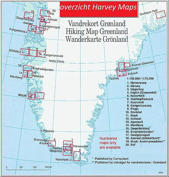
- Wandelkaart Groenland 2 Narsaq Hiking Map Greenland | Harvey Maps
- Wandelkaart Groenland 3 Qaqortoq Hiking Map Greenland | Harvey Maps
- Wandelkaart Groenland 4 Ivittuut Hiking Map Greenland | Harvey Maps
- Wandelkaart Groenland 5 Tasermiut Fjord Nanortalik Hiking Map Greenland | Harvey Maps
- Wandelkaart Groenland 6 Tasiilaq - Kulusuk Hiking Map Greenland | Harvey Maps
- Wandelkaart Groenland 8 Kangerlussuaq Hiking Map Greenland | Harvey Maps
- Wandelkaart Groenland 9 Pingu Hiking Map Greenland | Harvey Maps
- Wandelkaart Groenland 10 Sisimiut Hiking Map Greenland | Harvey Maps
- Wandelkaart Groenland 11 Nuuk Hiking Map Greenland | Harvey Maps
- Wandelkaart Groenland 11a Nuuk Omgeving Nuuk Hiking Map Greenland | Harvey Maps
- Wandelkaart Groenland 12 Ilulissat Hiking Map Greenland | Harvey Maps
- Wandelkaart Groenland 12b Ilulissat Hiking Map Greenland | Harvey Maps
- Wandelkaart Groenland 13 Apussuit Hiking Map Greenland | Harvey Maps
- Wandelkaart Groenland 14 Maniitsoq Hiking Map Greenland | Harvey Maps
- Wandelkaart Groenland 15 Qeqertarsuaq - Disko Island Hiking Map Greenland | Harvey Maps
- Wandelkaart Groenland 16 Evighedsfjorden Hiking Map Greenland | Harvey Maps
- Wandelkaart Groenland 17 Qasigianguit Hiking Map Greenland | Harvey Maps
- Wandelkaart Groenland 18 Aasiaat Hiking Map Greenland | Harvey Maps
- Wandelkaart Groenland 19 Nuuk Kapisillit Qooqqut & Austmannadalen Hiking Map Greenland | Harvey Maps
- Wandelkaart Groenland 20 Eqi - Alluttoq - Arveprinsen Ejland Greenland | Harvey Maps
- Wandelkaart Groenland 20c Eqi Greenland | Harvey Maps