- Gratis verzending vanaf 30 euro
- Levert in Nederland, België etc.
- Meer dan 30.000 titels
- Vakkundige klantenservice
- Snelle levering
- Veilig en eenvoudig betalen

Direct contact?
Bel +31 (0)6 42428571
maandag t/m vrijdag
van 10 tot 17 uur
Wandelkaart Toubkal & Marrakech Hiking Map
Water- en scheurvaste wandelkaart
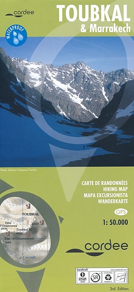
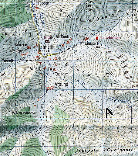
A detailed, accurate and up-to-date trekking map of Jebel Toubkal in the High Atlas mountains of Morocco, the highest peak in North Africa and popular trekking destination. A street plan of Marrakech is on the reverse. 1:50,000 topographic map detail includes contours at 20m intervals, hill-shading, woodland and scrub areas, springs, creeks, rivers and dry riverbeds. Road detail includes tracks and footpaths, and funicular railways and ski-lifts are also indicated. Isolated buildings are marked and symbols show ski-stations, refuges and religious buildings. A 1km UTM grid is drawn over the map and margin ticks are at 1' intervals.
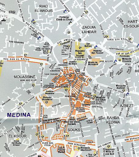
On the reverse is a clear plan of Marrakech at approximately 1:8,700. It covers the Medina district and extends westwards to the main railway terminus. Colours highlight main sites of interest, public buildings, shopping areas/markets and pedestrian zones. One-way streets are marked and symbols show a range of useful features e.g. hotels, taxi ranks, car parks.
Schaal: 1:50.000
Engels Frans Duits Spaans
EAN: 9781904207474
Auteur(s): Algemeen
Uitgeverij: Cordee
Meest recente editie
Engels Frans Duits Spaans
Op voorraad
Levertijd 4 dagen (Nederland) (wegens vakantie)
- Vakkundige klantenservice
- Groot assortiment
- Gratis retourneren binnen 14 dagen
- Aangesloten bij WebwinkelKEUR
€ 19,90
Meer producten die interessant kunnen zijn
4WD Atlas gebergte
Reisgids 4X4 Maroc 1 Pistes du Maroc Haut et Moyen Atlas Marokko | Gandini Guides
€ 37,50
Tijdelijk niet leverbaar