- Gratis verzending vanaf 30 euro
- Levert in Nederland, België etc.
- Meer dan 30.000 titels
- Vakkundige klantenservice
- Snelle levering
- Veilig en eenvoudig betalen

Direct contact?
Bel +31 (0)6 42428571
maandag t/m vrijdag
van 10 tot 17 uur
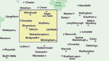
Fietskaart 22 Shropshire Staffordshire & the Black Country Cycle Map Sustrans Pocket Sized
van 9.99 voor 4.99!
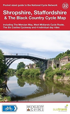
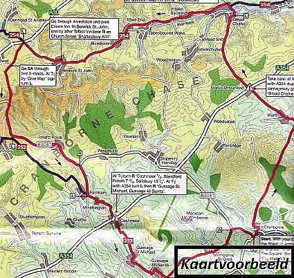
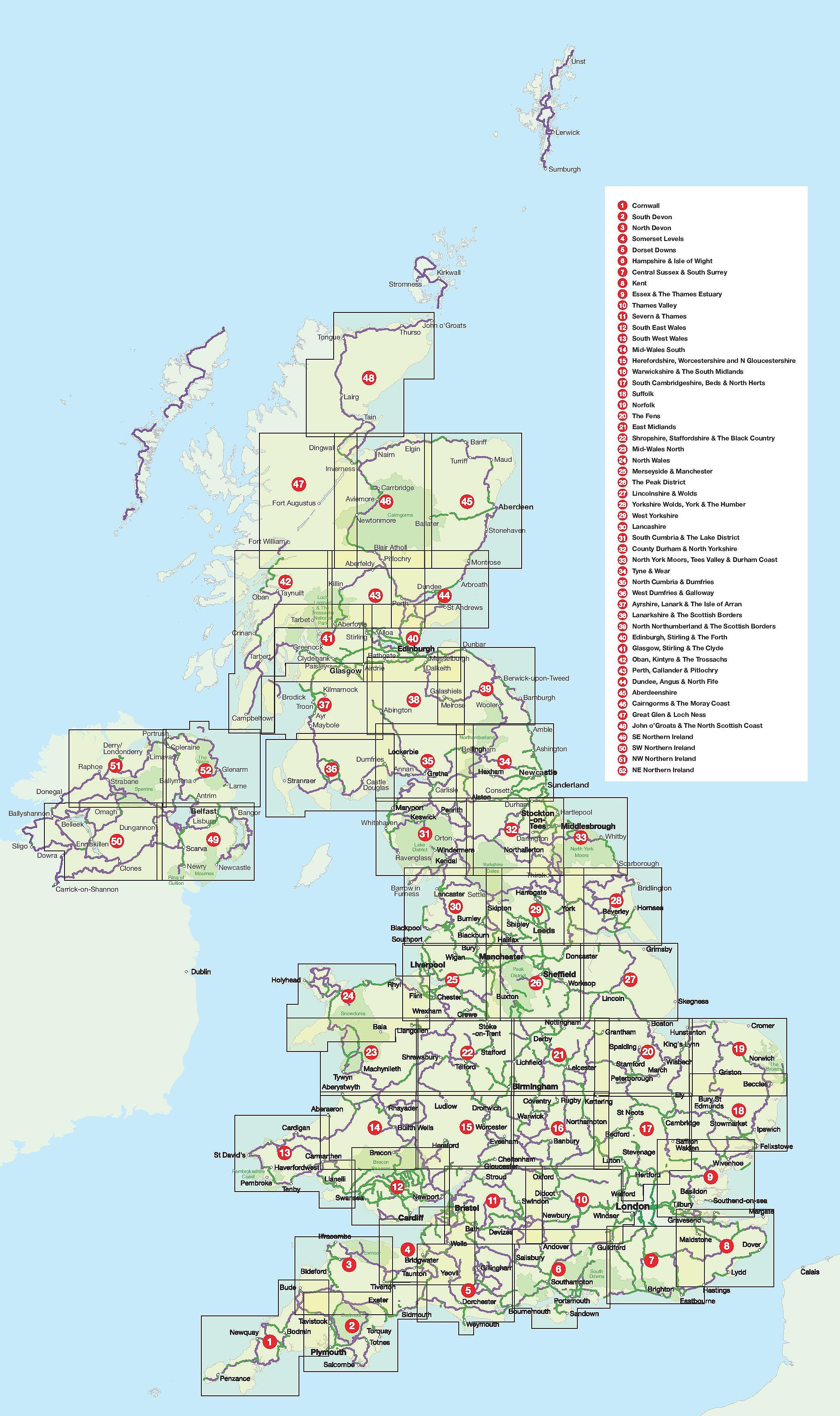
Mid-Wales South Cycle Map including the Ystwyth Trail, Elan Valley Trail, Lon Las Cymru, Lon Teifi, 3 day rides & 6 town centre maps. This is in the series of pocket sized, folded maps to the National Cycle Network which include clearly mapped on-road and traffic-free paths, easy to read contours and detailed town insets. The series is published by CycleCity Guides in partnership with Sustrans. 1:110,000 scale; folded.
Schaal: 1:110.00
Engelstalig
EAN: 9781900623377
Uitgeverij: Sustrans (UK)
Serie: Pocket Map Eng
Meest recente editie
Engelstalig
Op voorraad
Vóór 17 uur besteld, morgen in huis (Nederland)
- Vakkundige klantenservice
- Groot assortiment
- Gratis retourneren binnen 14 dagen
- Aangesloten bij WebwinkelKEUR
€ 4,99
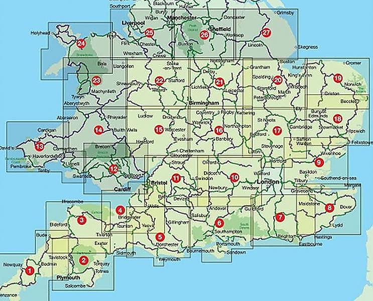
Verder in deze serie
- Fietskaart 16 Engeland Warwickshire & the South Midlands Cycle Map Sustrans Pocket Sized
- Fietskaart 21 East Midlands Cycle Map Sustrans Pocket Sized
- Fietskaart 36 West Dumfries & Galloway Cycle Map Sustrans Pocket Sized
- Fietskaart 38 Lanarkshire & The Scottish Boders Cycle Map Sustrans Pocket Sized
- Fietskaart 51 Derry-Londonderry the North west cycle map Cycle Map Sustrans Pocket Sized
- Fietskaart 52 The Causeway Coast & Glens Cycle Map Sustrans Pocket Sized
Meer producten die interessant kunnen zijn

Topografische Wandelkaart 139 Birmingham / Wolverhampton - Landranger Map
Wandelkaart & Fietskaart | Ordnance Survey (OS) Groot-Brittannië
€ 18,99
Topografische Wandelkaart 150 Worcester / The Malverns Evesham & Tewkesbury - Landranger Map
Wandelkaart & Fietskaart | Ordnance Survey (OS) Groot-Brittannië
€ 18,99
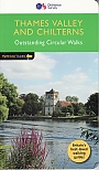
Wandelgids 25 Thames Valley and Chilterns Pathfinder Guide
Pathfinder Guide 25 | Met Ordanance Survey kaarten
€ 17,99

Wandelgids 252 Engeland Mitte | Rother Bergverlag
Im herzen von den Cotswols zum Peak District 52 wandelingen
€ 14,90
Tijdelijk niet leverbaar