- Gratis verzending vanaf 30 euro
- Levert in Nederland, België etc.
- Meer dan 30.000 titels
- Vakkundige klantenservice
- Snelle levering
- Veilig en eenvoudig betalen

Direct contact?
Bel +31 (0)6 42428571
maandag t/m vrijdag
van 10 tot 17 uur
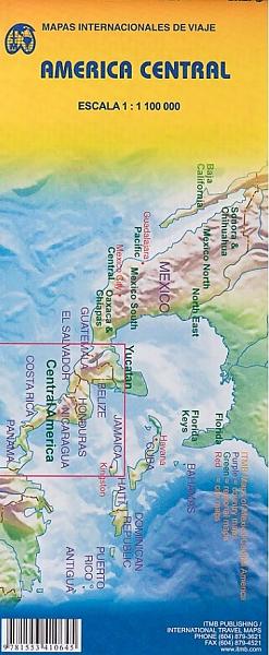
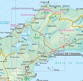
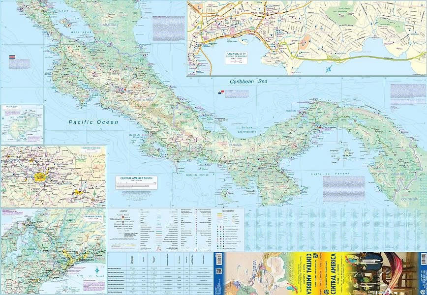
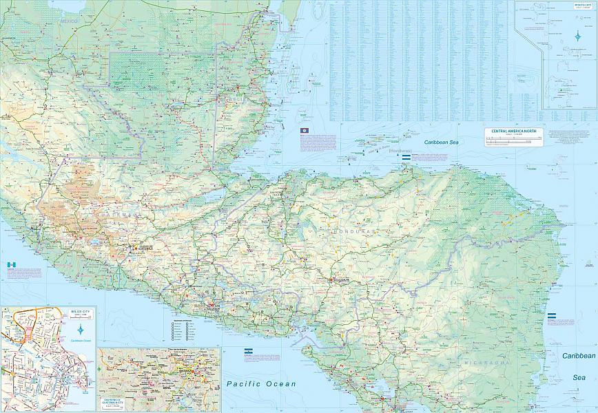
Wegenkaart - Landkaart Centraal Amerika - ITMB Map
Water- en scheurvaste wegenkaart
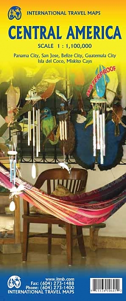
De ITMB kaarten kenmerken zich door een kleurrijke en volle cartografische weergave. Het zijn degelijke kaarten, zeker voor gebieden waarvoor kaarten lastig te krijgen zijn, met aanduidingen van onder andere nationale parken en natuurgebieden, vliegvelden, toeristische bezienswaardigheden en een goede aanduiding van het wegennet. Daarnaast bevatten enkele kaarten ook stadsplattegronden (hoofdsteden of belangrijke centra). Bevat voor sommige landen ook aanduidingen in de orginele taal. There are relatively few changes to this edition. At this scale, there would have to be a new canal across Nicaragua or some such mega-project to even show on the map. The map is double-sided, with one side concentrating on Guatemala, Belize, and Honduras, with inset maps of Belize City and the environs of Guatemala City, and the other side focusing on the more southerly countries of Central America. This side has inset maps of San Jose (Costa Rica), the Panama Canal area, and of Panama City itself. My only comment about the artwork is that we have received conflicting information as to whether or not the road south to Yaviza is paved yet or not, so we have chosen to show it as unpaved pending future clarification. We have driven this road, and it is a mudbath when wet. Yaviza is still the end of the Pan-American Highway North, which then continues from a point in Colombia south to Chile. Folded color road and travel map. Scale 1:1,100,000. Distinguishes roads ranging from highways (paved/unpaved) to seasonal tracks. Legend includes swamps, glaciers, reefs, active volcanoes, railways, ferry routes, protected areas/national parks, international airports, domestic airports with scheduled services, landing grounds, points of interest, ruins, lighthouses, mines, beaches, gas stations, border crossing points. Includes inset map of Panama Canal Area, Isla del Coco. Extensive index, general information on the listed countries.
Schaal: 1:1.900.000
EAN: 9781553410645
Auteur(s): Algemeen
Uitgeverij: ITMB (International Tavel Maps & Books)
Meest recente editie
Op voorraad
Vóór 17 uur besteld, morgen in huis (Nederland)
- Vakkundige klantenservice
- Groot assortiment
- Gratis retourneren binnen 14 dagen
- Aangesloten bij WebwinkelKEUR
€ 13,50
Meer producten die interessant kunnen zijn
Wegenatlassen Noord-Amerika