- Gratis verzending vanaf 30 euro
- Levert in Nederland, België etc.
- Meer dan 30.000 titels
- Vakkundige klantenservice
- Snelle levering
- Veilig en eenvoudig betalen

Direct contact?
Bel +31 (0)6 42428571
maandag t/m vrijdag
van 10 tot 17 uur
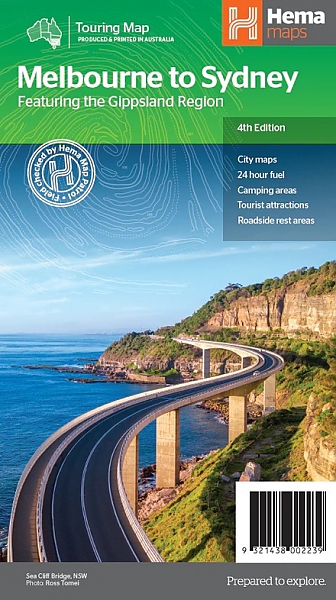
Wegenkaart - Landkaart Melbourne tot Sydney - Hema Maps
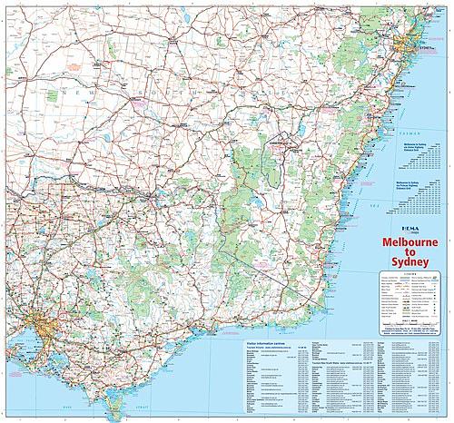
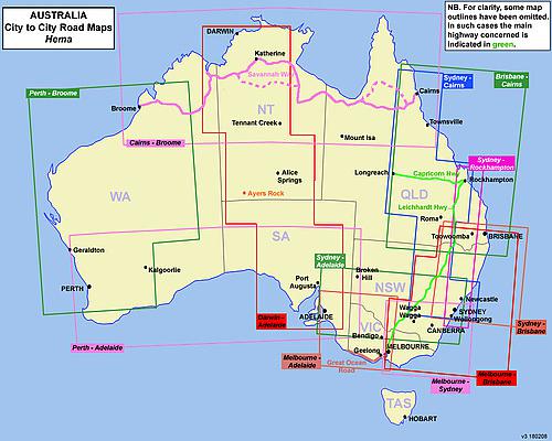
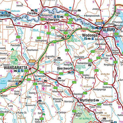
Hema Maps, een uitgever uit Australie, maakt fantastische kaarten welke zich kenmerken door het overzichtelijke en rustige karakter. Op de meeste kaarten zijn de dorpen en steden duidelijk aangegeven, inclusief de additionele informatie voor onderweg. Hierbij kun je denken aan een afstandstabel, tankstations, campsites, wegtype, tolwegen, regionale verbindingswegen rondom de steden, spoorwegen en andere belangrijke orientatiepunten. Daarnaast staan op de meeste kaarten ook toeristische bezienswaardigheden aangegeven, zoals natuurparken, natuurfenomen, musea, monumenten, opgravingen enzovoorts. This map takes you from Melbourne to Sydney via the Princes and Hume Highways and everything in between. The map also features text and photographs of places of interest along the way. Also included on the map is National Park information and inset maps of the major roads through Sydney and Melbourne. Routes between Melbourne and Sydney in Hema’s range of very popular touring maps showing roads connecting Australia’s main centres of population along some of the most spectacular routes such as the Great Ocean Road or the Savannah Way. The maps highlight 24-hour fuel supplies, roadside rest areas, camping facilities, places of interest, etc., and include distance charts and, in some titles, city maps. Road network indicates unsurfaced roads and tracks. The maps also show railway lines. There is no topographical information beyond names of mountain ranges and selected peaks, plus rivers and lakes, but national and state parks, conservation areas and reserves, and aboriginal lands are all highlighted. The maps have a grid showing latitude and longitude at intervals of 1º or 2º. In this title: the road network in the south-eastern corner of Australia, highlighting facilities along both the two main routes connecting these two cities, the Princes and the Hume highways, and on other state and local roads. Numerous campsites and caravan parks are indicated in the mountain ranges and the national parks. The map has tables showing facilities in the national parks of both states and distances between the two cities along the two highways. Also included are enlargements showing through roads across the suburbs and environs of Melbourne and Sydney, lists of information centres, and notes on places of interest. Latitude/longitude grid is at 1º intervals.
Schaal: 1:900.000
Engelstalig
EAN: 9321438002239
Auteur(s): Algemeen
Uitgeverij: Hema Maps Australia
Meest recente editie
Engelstalig
Op voorraad
Vóór 17 uur besteld, morgen in huis (Nederland)
- Vakkundige klantenservice
- Groot assortiment
- Gratis retourneren binnen 14 dagen
- Aangesloten bij WebwinkelKEUR
€ 15,50