- Gratis verzending vanaf 30 euro
- Levert in Nederland, België etc.
- Meer dan 30.000 titels
- Vakkundige klantenservice
- Snelle levering
- Veilig en eenvoudig betalen

Direct contact?
Bel +31 (0)6 42428571
maandag t/m vrijdag
van 10 tot 17 uur
Wandelkaart East Highland Way | Harvey Maps
Water- en scheurvaste wandelkaart
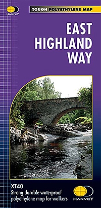
De Harvey Map is de wandelkaart voor het wandelen in de mooiste natuurgebieden in het Groot-Brittannië. Duidelijke topografische wandelkaarten met praktische informatie van de route zoals overnachtingsmogelijkheden, eetgelegenheden en bezienswaardigheden. Deze wandelkaart is scheur- en watervast. Met GPS compatible (UTM-Grid). Compact and light - the map itself weighs just 60gms - a third of the weight of a laminated map, and much less bulky. And you can fold or refold it time and again, or stuff it in your back pocket and it won't fall to pieces. Shows the entire route on one sheet.
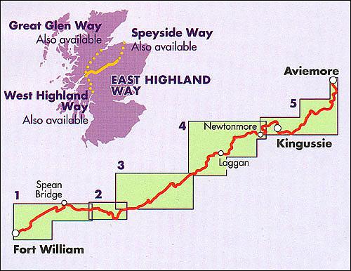
The Way is 132km (82 miles) from Fort William to Aviemore and forms a new link between the northern end of of the West highland Way and the southern end of the Speyside Way. It also joins the Great Glen Way at Fort William. The route is tranquil and takes in a varied and wild landscape and includes the ancient Caledonian Forests of Inshriach, loch-side trails and mountain wilderness. Access to accommodation has been carefully considered wherever possible, making this route accessible to walkers of all abilities.
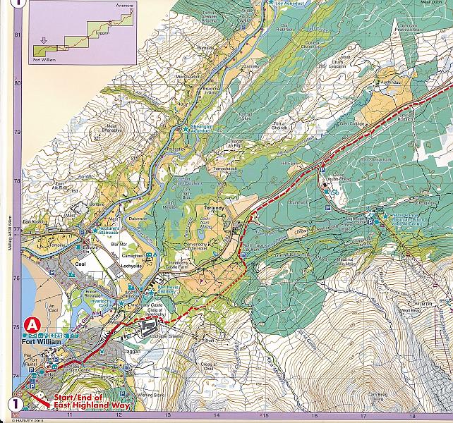
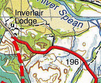
The map is arranged in panels so that at any one time you only have to have the part you need open. It is supplied folded in a plastic pocket. The map shows the detail you need for navigation. There is a full key and scale bar.
Schaal: 1:40.000
Engelstalig
Op voorraad
Levertijd 3 dagen (Nederland)
- Vakkundige klantenservice
- Groot assortiment
- Gratis retourneren binnen 14 dagen
- Aangesloten bij WebwinkelKEUR
€ 25,99
Meer producten die interessant kunnen zijn
Topografische kaarten Centraal-Schotland / Ben Nevis
Topografische Wandelkaart 36 Grantown / Aviemore Cairngorm Mountains - Landranger Map
Wandelkaart & Fietskaart | Ordnance Survey (OS) Groot-Brittannië
€ 18,99

Topografische Wandelkaart 392 Ben Nevis / Fort William The Mamores & The Grey Corries Kinlochleven & Spean Bridge - Explorer Map
Wandelkaart & Fietskaart | Ordnance Survey (OS) Groot-Brittannië
€ 18,99
Topografische Wandelkaart 35 Kingussie / Monadhliath Mountains - Landranger Map
Wandelkaart & Fietskaart | Ordnance Survey (OS) Groot-Brittannië
€ 18,99
Topografische Wandelkaart 56 Loch Lomond / Inveraray - Landranger Map
Wandelkaart & Fietskaart | Ordnance Survey (OS) Groot-Brittannië
€ 18,99
Wandelgidsen Centraal-Schotland / Ben Nevis
Wandelgids 23 Loch Lomond, The Trossachs and Stirling Pathfinder Guide
Pathfinder Guide 23 | Met Ordanance Survey kaarten
€ 17,99