- Gratis verzending vanaf 30 euro
- Levert in Nederland, België etc.
- Meer dan 30.000 titels
- Vakkundige klantenservice
- Snelle levering
- Veilig en eenvoudig betalen

Direct contact?
Bel +31 (0)6 42428571
maandag t/m vrijdag
van 10 tot 17 uur
Wegenatlas Ierland Road Atlas Ireland Ordnance Survey
Met spiraalbinding Formaat verkleind A4

This edition contains updated road maps covering Ireland, plus City and Town Maps and Motoring Information, Distance Charts and Extensive Gazetteer (Index of Towns). This new 8th edition is published in conjunction with Ordnance Survey Northern Ireland and the Road Safety Authority (RSA) and features Collision Zones, Speed Detection Zones and Tolled Roads. (This product is produced with the co-operation of Ordnance Survey Northern Ireland, OSNI).
Schaal: 1:210.000
Engelstalig
EAN: 9781912140473
Uitgeverij: Ordnance Survey (UK)
Verschijningsdatum: 2021
Meest recente editie
Engelstalig
120 pagina's


EAN: 9781912140473
Uitgeverij: Ordnance Survey (UK)
Verschijningsdatum: 2021
Engelstalig
direct leverbaar
24,90
Meer producten die interessant kunnen zijn
Wegenkaart - Landkaart Ireland North Ierland Noord Ordnance Survey
Wegenkaart | Ordnance Survey (OS) Ireland
€ 18,99

Wandelgids 255 Ierland Irland mit Nordirland Rother Wanderführer | Rother Bergverlag
67 Wandelingen | Die schönsten Küsten- und Bergwanderungen
€ 16,99
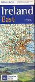
Wegenkaart - Landkaart Ireland East Ierland Oost Ordnance Survey
Wegenkaart | Ordnance Survey (OS) Ireland
€ 18,99