- Gratis verzending vanaf 30 euro
- Levert in Nederland, België etc.
- Meer dan 30.000 titels
- Vakkundige klantenservice
- Snelle levering
- Veilig en eenvoudig betalen

Direct contact?
Bel +31 (0)6 42428571
maandag t/m vrijdag
van 10 tot 17 uur
Klimgids Scrambles in Lochaber Cicerone Guidebooks
A guide to scrambles in and around Lochaber including Ben Nevis

This guide describes some of the best scrambles to be found within a 45km radius of the town of Fort William, an area which includes not only Ben Nevis and Glen Coe, but also Ben Alder to the east, Ben Cruachan to the south, Garbh Bheinn to the west and The Saddle to the north. Most of this area falls within the Lochaber Area of the Highland Council. It is the most popular area in the whole of Scotland with hillgoers, and justifiably so, for it contains some of the most varied and spectacular mountain scenery in the Highlands. The guide contains over seventy routes in Lochaber. This guide is for those who seek more interesting routes. A number of the scrambles described here have been popular for years and are fairly well worn, but many others are little frequented and consequently have a certain pioneering atmosphere about them. Some experience of route finding will be useful in such cases. The majority of scrambles involve lengthy sections of hillwalking in approach or descent, and this should be taken into account when planning an outing.
Engelstalig
EAN: 9781852842345
Auteur(s): Williams, n.
Uitgeverij: Cicerone Press
Verschijningsdatum: 2009
Meest recente editie
Engelstalig

(Tijdelijk) niet leverbaar
- Vakkundige klantenservice
- Groot assortiment
- Gratis retourneren binnen 14 dagen
- Aangesloten bij WebwinkelKEUR
Meer producten die interessant kunnen zijn
Topografische kaarten Centraal-Schotland / Ben Nevis
Topografische Wandelkaart 36 Grantown / Aviemore Cairngorm Mountains - Landranger Map
Wandelkaart & Fietskaart | Ordnance Survey (OS) Groot-Brittannië
€ 18,99
Topografische Wandelkaart 41 Ben Nevis / Fort William / Glen Coe - Landranger Map
Wandelkaart & Fietskaart | Ordnance Survey (OS) Groot-Brittannië
€ 18,99

Topografische Wandelkaart 392 Ben Nevis / Fort William The Mamores & The Grey Corries Kinlochleven & Spean Bridge - Explorer Map
Wandelkaart & Fietskaart | Ordnance Survey (OS) Groot-Brittannië
€ 18,99
Topografische Wandelkaart 373 Iona / Staffa / Ross of Mull - Explorer Map
Wandelkaart & Fietskaart | Ordnance Survey (OS) Groot-Brittannië
€ 18,99
Wandelgidsen Centraal-Schotland / Ben Nevis
Wandelkaarten Centraal-Schotland / Ben Nevis
Wandelkaart West Highland Way - National Trail Maps | Harvey Maps
Water- en scheurvaste wandelkaart
€ 25,99
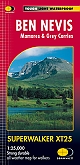
Wandelkaart Ben Nevis - Walking Maps Superwalker | Harvey Maps
Water- en scheurvaste wandelkaart
€ 25,99
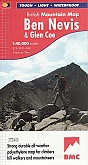
Wandelkaart Ben Nevis and Glen Coe - Mountain Map | Harvey Maps
Water- en scheurvaste wandelkaart
€ 28,99
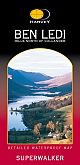
Wandelkaart Ben Ledi & Hills North of Callander - Walking Maps Superwalker | Harvey Maps
Water- en scheurvaste wandelkaart
€ 17,99