- Gratis verzending vanaf 30 euro
- Levert in Nederland, België etc.
- Meer dan 30.000 titels
- Vakkundige klantenservice
- Snelle levering
- Veilig en eenvoudig betalen

Direct contact?
Bel +31 (0)6 42428571
maandag t/m vrijdag
van 10 tot 17 uur
Fietskaart Lochs & Glens NN7C Cycle Map Sustrans

Sustrans kaarten geven een goed overzicht van het National Cycle Network. 25.000 km lang is het fietsnetwerk inmiddels. De routes zijn bewegwijzerd, autoluw en fietsvriendelijk. Oude spoorwegen zijn omgetoverd in fietspaden of er wordt gebruik gemaakt van jaagpaden langs waterwegen. De cartografie is duidelijk met veel praktische informatie. The Discover series of Sustrans official cycle route maps provide clearly mapped cycle routes on traffic-free paths, quiet lanes and traffic-calmed roads.
This is Sustrans National route 7 from Glasgow to Inverness and is a beautiful route passing through two national Parks. Loch Lomond and the Trossachs National Park contains lochs, foests and bustling towns. The Cairngorms National Park extends over the Uks larges mountain range. A traffic-free path takes you from Glasgow, along the rivers Clyde and Leven, to the shores of Loch Lomond. The route takes in the lochs of Drunkie, Venachar, Lubnaig, Earn and Tay. Glen Ogle with its old railway viaducts is one of the highlights of the route.
Schaal: 1:100.000
Engelstalig
EAN: 9781901389623
Auteur(s): Algemeen
Uitgeverij: Sustrans (UK)
Serie: Sustrans National Cycle Network
Meest recente editie
Engelstalig

Op voorraad
Vóór 17 uur besteld, morgen in huis (Nederland)
- Vakkundige klantenservice
- Groot assortiment
- Gratis retourneren binnen 14 dagen
- Aangesloten bij WebwinkelKEUR
€ 10,95
Verder in deze serie
- Fietskaart Lon Las Cymru South NN8A Cycle Map | Sustrans
- Fietskaart NN24 Bath to Bournemouth Cycle Map Sustrans
- Fietskaart Noord-Ierland The North West Trail NN92 Cycle Map | Sustrans
- Fietskaart Noord-Ierland The Sperrins Region Cycle Map | Sustrans
- Fietskaart Oban to Campbeltown NN78 Cycle Map | Sustrans
- Fietskaart Wales Celtic Trail East Cycle NN4B Map | Sustrans
Meer producten die interessant kunnen zijn
Topografische kaarten Centraal-Schotland / Ben Nevis
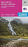
Topografische Wandelkaart 41 Ben Nevis / Fort William / Glen Coe - Landranger Map
Wandelkaart & Fietskaart | Ordnance Survey (OS) Groot-Brittannië
€ 18,99
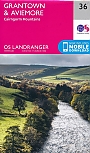
Topografische Wandelkaart 36 Grantown / Aviemore Cairngorm Mountains - Landranger Map
Wandelkaart & Fietskaart | Ordnance Survey (OS) Groot-Brittannië
€ 18,99

Topografische Wandelkaart 392 Ben Nevis / Fort William The Mamores & The Grey Corries Kinlochleven & Spean Bridge - Explorer Map
Wandelkaart & Fietskaart | Ordnance Survey (OS) Groot-Brittannië
€ 18,99
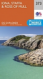
Topografische Wandelkaart 373 Iona / Staffa / Ross of Mull - Explorer Map
Wandelkaart & Fietskaart | Ordnance Survey (OS) Groot-Brittannië
€ 18,99
Wandelgidsen Centraal-Schotland / Ben Nevis
Wandelkaarten Centraal-Schotland / Ben Nevis
Wandelkaart West Highland Way - National Trail Maps | Harvey Maps
Water- en scheurvaste wandelkaart
€ 25,99
Wandelkaart Ben Nevis - Walking Maps Superwalker | Harvey Maps
Water- en scheurvaste wandelkaart
€ 25,99
Tijdelijk niet leverbaar
Wandelkaart Ben Nevis and Glen Coe - Mountain Map | Harvey Maps
Water- en scheurvaste wandelkaart
€ 28,99

Wandelkaart Ben Ledi & Hills North of Callander - Walking Maps Superwalker | Harvey Maps
Water- en scheurvaste wandelkaart
€ 17,99